Saturday, September 15, 2018

Steamboat Springs


Today was a short drive to Steamboat Springs. A down day to relax, clean the trailer, read, and then we took a short hike to Fish CreekFalls, just outside of town. The fall colors are here in the scrub oak and Aspen, but the temperature is 88, so there are kids playing in the swimming pool. We can see another fire further east of us. We went to Mahogony Ridge Brewery for some beer and a delicious dinner.

Fish Creek Falls

As usual, we really enjoyed our camping trip. While the fires we encountered throughout the west, made for poor visibility, it was 
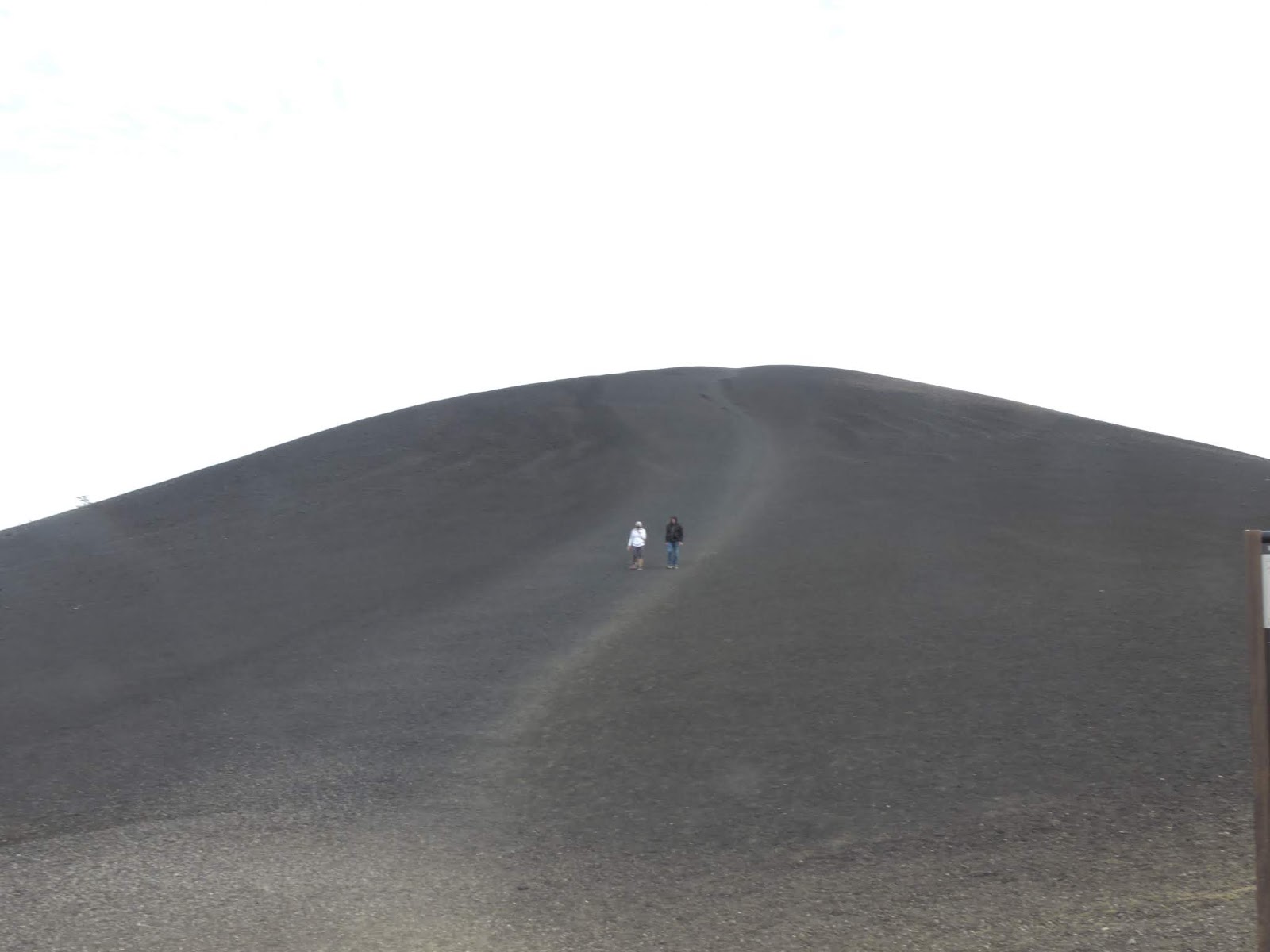
still a very scenic trip. We were surprised to learn that southern Idaho was filled with old calderas, it added a lot to our Yellowstone knowledge. It was great to see some of Vancouver, but next time, we won’t come on a holiday weekend. Char and Dick were gracious to accompany us on our tour of the Seattle area. Can’t wait to do another extended camping trip.

If you want to see more pictures and videos, there is video of the entire trip on youtube

Friday, September 14, 2018

Dinosaur National Park

Smoke plums north of the Canyon

This is our fourth visit to Dinosaur National Park. We decided that instead of going to the fossil quarry and other sights near there, we would head to the Canyon Area in the central portion of the park. A paved road goes in about 30 miles from U.S. 40. It has numerous awesome view points of the colorful canyon formations. We also could see the smoke plumes from another fire north of us. We were tempted to take the 13 mile dirt road to Echo Park, but because of the time, we’ll have to try that next time (combined with an earlier start).

The Road to Echo Park


After having many varied canyon formations, we reached the end of the road. Here there is a 2 mile hike that culminates the trip. I headed out on a peninsula high above the canyons. First you get a view of the settlement in Echo Park. Next comes a view of the twisting Yampa River heading into the park. Then a view of  Whirlpool canyon of the Green River. Around you are water-shaped red rocks similar to those deep in the canyon. The rocks change to black sedimentary rock with shell fossils showing. Finally you're at the point of this peninsula of land looking at the joining of the Yampa  and the Green with Steamboat Rock hiding the junction. This hike was as picturesque as Angel's Landing in Zion National Park, but the trail was a whole lot easier to hike.


Thursday, September 13, 2018

Museum of Idaho


Time Machine and Steampunk Creator

Our stop of the day was the Museum of Idaho in Idaho Falls. We lucked out on this stop, because they had a superb temporary exhibit on Steampunk. This was a mix of art and science celebrating the inventors and science fiction writers of the 19th century: George Eastman, Issac Singer, Mary Shelby, H.G. Wells, and Jules Verne. The artworks were inspired by their invention (real or fiction) and included some form of lights and motion. Nearby were examples of inventions that followed their invention or fiction. Quite entertaining as well as educational. My favorite was an inventor, I never heard of, Jan Matzeliger. His invention sewed the top cover of a shoe to the sole, increasing the output of a cobbler from 4 shoes a day to 100.

Jan Matzeliger and shoe art

Most of the rest of the museum wasn't very special, except for the small section about the National Reactor Testing Station. Created after World War II, they developed over time 52 prototype nuclear reactors, including the first one to power a town (Arco, Idaho) and the reactor for the Navy Submarine Nautilus. It was entertaining to watch a 1950 era cartoon, explaining how a nuclear reactor works to a public that associated nuclear with atomic bombs.

Nuclear Fuel and Control Rods

We camped that night just east of Salt Lake City in DeerCreek State Park. The park is by a reservoir and would have been great except for the smoke that was coming into the valley from a nearby forest fire.

Smoke encroaching on Deer Creek State Park


Wednesday, September 12, 2018

Craters of the Moon


We did find gas after 23 miles. Then we headed across Southern Idaho to Craters of the Moon National Park. I was not sure whether we could find a trailer site there, so we camped at the Arco KOA and then returned to the park. Turns out we could have found a campsite at the park.

Inferno Cinder Cone

The visitor center has a display that explained the geology of the Snake River Valley in Southern Idaho. It is a series of volcanic caldera that stretches across the state all the way to Yellowstone. That is where the active hotspot is today, but because of continental plate drift, the calderas in Idaho used to each be over that hotspot over time. Craters of the moon looks different than the other caldera because it is so new. It still has lava flow about every 2000 years. (The last major flow was 2100 years ago.) Here you can find lava tubes, lava coils, and sputtered lava. We learned about aa lava, the rough jagged lava as well as pahoehoe lava which looks like rope.

Pahoehoe Lava

Here too are both cinder cones,  and sputter cones. As you look around the area you can see numerous cones in the distance. Older comes are now grass covered and newer comes are bare rock. The whole idea of multiple calderas in Utah was new to us, it really makes sense to combine a visit here with a visit to Yellowstone National Park.


Tuesday, September 11, 2018

Oregan Trail Interpretive Center

Remnants of the Oregon Trail


We traversed a large portion of eastern Oregon today. Our stop for the day was the National Historic Oregon Trail interpretive center. This is a well-done museum explaining the story of the Oregon Trail in plaques, displays, and a long, but good movie. You got a sense of how difficult this 6-month journey was. Indians weren't the major problem, but poor water, breakdowns, and disease took their toll, resulting in one grave every six miles. Most people walked the entire way, using their oxen to pull their wagon full of supplies and what they would need in Oregon. Most luxury goods, and heavy items like stoves and anvils were tossed on the trail as the oxen struggled with the weight.

Prarie Schooner

We headed for our campsite in Hell's Canyon. Forty years ago, when we were last here, we got lost because of poor signage and had to turn our little tent trailer around on a narrow road. The same thing happened to us today. We knew we needed to find the road that traveled south near the Snake river. We missed it and had to turn around our large trailer on a shelf road above the reservoir. Luckily, I found a spot wide enough after only a couple miles. As we headed back we found the small sign pointing to the road we had missed. We camped that night at the Woodhead Park campground on the reservoir in Hells Canyon. Neither of us slept well that night, after getting lost in the canyon AGAIN, and knowing we only had 50 miles to find gas.

Monday, September 10, 2018

Columbia River Gorge


We headed to the Columbia River Gorge with our trailer behind, which I knew would limit our parking opportunities. We had to skip Vista House, but managed to see most of the water falls: Latourell Falls, Sheppard's Dell and Multanomah Falls, which you can see from an exit off I-80.

We then went to the Bonneville Dam on the Columbia. This dam only generates about a fifth the power of the Grand Coulee, but it is impressive none the less. The fun part of visiting this dam is to watch the salmon and other fish swim up the fish ladders.


Our final stop of the day was the Columbia Gorge Interpretive center. It gives the history of the area from Indian days forward. It was particularly interesting to hear of the difficult choice those on the Oregon Trail had to make this close to their goal of the Willamette Valley near the coast. Either they had to float their prairie schooners over the Rapids or take a toll road ($8 a wagon) around Mount Hood with a narrow steep drop on the far side where they had to winch their wagon down the slope.  They also had an excellent exhibit on the Eagle Creek Fire which happened in September, 2017, which has forced closure of some of the Historic Columbia River Highway.

Eagle Creek Fire 


After the center, the landscape quickly changes from forests to dry semi-arid coulee. We camped at Maryhill State Park, an oasis of green in the brown grasses.

Sunday, September 9, 2018

Mount St. Helens


Seaquest State Park

We headed south to camp in Seaquest State Park. The campsites are underneath a tall canopy of trees. After lunch we took WA 504 toward Mt. St. Helen. There were several vista points along the way. Our first stop was the Forest Learning Center. Weyrhauser explained their forestry operations after the eruption. They first made use of much of the timber that had been blown over after the eruption. They also found out that to replace the forest, they had to plant seedlings below the layer of ash. The ash did not have enough nutrients for growth. Today they have a healthy, tall forest that they have begun harvesting. It was quite interesting to see video of their automated saw mills.  Even cutting down trees in the forest has been made easier with machines that can cut the tree, chop off its limbs, and cut it into proper lengths for loading on the trucks.

Mount St. Helens

We continued on to several viewpoints of the mountain until reaching the Johnson Ridge Observatory. Here we listened to a ranger talk explaining what happened here in 1980. The explosion destroyed an area the size of Chicago in less than 4 minutes, burning the trees nearby and blowing down the trees further on. But those who were nearby saw this in silence! The sound waves went straight up, eventually bouncing off the layers of the atmosphere, so that those farther away heard the explosion. A wall of mud 40 foot high flowed down the mountain completely changing the landscape. Where once there had been 30 ponds, today there are 150 including Cold Water Lake. The temperature of the water rose to 90 degrees Farenheit. 


A national monument was created which allows us to study how nature recovers from a volcanic explosion. It took 2 years for elk to return, by then, there was enough vegetation for food. The first summer saw one prairie lupin blossoming, in five years they covered the valley. After the explosion, over time a 1000 foot high lava dome formed and today a new glacier 600 feet thick surrounds the dome.

Saturday, September 8, 2018

Olympic National Park - Beaches and Rain Forest

Ruby Beach

We headed west and south around the Olympic Peninsula. Our first  stop was Ruby Beach. Through the mist and rain we saw some rock haystacks close to shore which provide a safe habitat for birds. Along the shore were large logs, we explored the shoreline until the rain started pouring. We then continued on to Beach #1 which had a short nature trail around a grove of Spruce trees. The trees were unique because of their huge burls.

Burls on the Spruce Tress

We headed on to the Lake Quinault section of the park on the south side. Here we took a hike through the rain forest. What was surprising is that we were walking through moss-covered maple trees, not spruce tress. Just think of what the color would be in a few weeks. We continued on to an old homestead with a mix of five or so buildings, old and new. Finally, we took the loop road around the lake. Then we bid farewell to Dick and Char, while we spent the night in camp. Next to us was the world's largest Cypress, 58 feet in circumference . I guess it helps a tree's growth if you get 12 feet of rain a year.

World's Largest Cypress Tree


Friday, September 7, 2018

Hurricane Ridge, Olympic National Park

John, Mary, Dick and Char at Hurricane Ridge

Today, Dick and Char joined with us to camp outside Olympic National Park. Today we visited the Hurricane Ridge section of the park. The ridge is so named because of the fierce winds atop the 5500 foot ridge. We did a short hike from the visitor center getting a 360 degree view from glaciers in the mountains to our west to seeing Vancouver Island across the strait. (All our phones got a Welcome to Canada message as we picked up their cell phone towers. We also found 3 deer and 2 marmots on the trail. We headed down to sea level and then west to the Lake Crescent area to take another hike, but it started pouring rain, so we headed back to camp at ElwahDam Campground.

We found deer


Thursday, September 6, 2018

Tacoma

1926 Rolls Royce Ghost


We started our day at America's Car Museum. This place brings together several car collections. I particularly enjoy seeing the handcrafted cars from the early 20th century, they are well represented here. Of course, they also have the more familiar makes of cars from the 20s through the 60s. The placards on the autos would explain the unique features of each auto. An especially interesting section of the museum was about Route 66 – the unique diners, motels, and attractions that encouraged vacationers to travel by car.

Wigwam Motels on Route 66

In the afternoon, we went to the Museum of Glass. Here we saw more Chihuly works and those by other artists. The museum would have been a disappointment because their main gallery was closed for a change in exhibits. But they also have a hot shot here, where they are creating glass pieces. We spent a fascinating hour watching all the work they put into create a large flask shaped bottle. That evening we had a steak and salmon dinner at Dick and Char's and daughter Julie joined us. 


Wednesday, September 5, 2018

Seattle


An early toilet


Dick and Char joined us for our quick tour of Seattle. We took the rail line into town from south of the airport. The Underground Tour of Seattle gave us the early history of the town. We had a great guide, who told entertaining stories as we explored Pioneer Square above and below ground. Founded near the shore line the early city had wooden buildings, wooden sidewalks and used sawdust from the sawmill to fill in the holes. The town used to have their outhouses near the beach. The sewage would move up and down the bay as the tide changed. This was unsanitary for the city and they knew something must be done. Toilets had recently been invented in England, but they needed a sewage system to attach to. The town built a sewer system using wood pipes. But the pipes were too close to sea level and were affected by the tides, sometimes exploding sewage up the toilet.

The ladders to access ground floors

In 1889, a fire destroyed 33 blocks of Seattle. The city decided that downtown buildings would be rebuilt with brick, not wood, each building must be at least 3 stories high, because the were going to raise the street level one floor and raise the sewer system to avoid exploding toilets. Each buildings' first floor would become the basement. For 4 years, people had to go up and down ladders to get from street level to business level until the sidewalks could also be raised. Underneath the sidewalks is Seattle's Underground. It used to be used as marketplaces, then as storage. We found lots of junk including parts of an Otis elevator. The underground tour was mostly learning about Seattle's history from 1850 to 1900, but made much more interesting by walking underneath the sidewalks.

We then headed along 1st street to Pike's Market, a street market common in most countries, but rare in the US, selling everything from flowers to fish. 

Space Needle

Then we took the monorail to Seattle Center home of the Seattle World's Fair and the symbol of Seattle: the Space Needle. We took in the Chihuly Glass Museum. He has a unique style of art and this museum has a large selection of his pieces. Just as interesting were some of the short films on some of his projects across the World.

Chihuly - Ikeban Float


Tuesday, September 4, 2018

Boeing Factory Tour

Boeing Tour


We left Vancouver and headed back into the States, best thing – we didn't have to buy gas in Canada. We stopped in Everett for the Boeing factory tour. The assemble the 747, 767, 777, and 787 here in the largest building by volume in the states. Big enough to hold Disneyland inside. For me the biggest surprise was the multiple platforms they use to assemble the planes. For the 747 and 767, they assemble the cockpit at one station, wings and stabilizers at other stations and then assemble them all together in four stations on the other side of the building. The 777 and 787 have their major parts flown in from elsewhere and then are assembled here. The tour guides are good and they really sell the Boeing culture and product. Now if I only had $97 million to buy a 737 (the seats and engines are extra).

737s all in a row


Tonight we're at the Kent KOA halfway between Seattle and Tacoma. The location proved ideal.

Monday, September 3, 2018

Grouse Mountain


Grouse Mountain is a ski area just outside Vancouver. In the summer you take their gondola up to the top of the mountain to participate in their activities. We started with the lumberjack show. This show is designed around a lumberjack competition (tree climbing and log rolling) but it's funny too. The highlight was a “tourist" climbing to the top of their 60 foot long pole and then balancing on the top  in a head stand. 

The best exhibit was the two 17 year old grizzly bears. They both had been orphaned as cubs, but have been raised here as naturally as possible. For example, they have to hunt for their hidden food and hibernate for the winter in a man made cave. They are locked in their cave, and the fences are removed, allowing the skiers full access to the mountain. We enjoyed watching the bears graze in the grasses and play in the stream.

Then we watched a bird of prey show with a bald eagle, Harrison Hawk, Turkey Vulture, Gyr Falcon, and Great Horned Owl. The birds flew right over our heads while their trainers explained each bird's traits. For an extra charge you can use the rope course,  bike the paths, or dangle from the zip lines.  We had lunch on top before ending our day. A pricey, but fun day.

Sunday, September 2, 2018

VanDusen Botanical Gardens


This day comes on every long trip – wash day. But a nice surprise, the machines were available and it was only $1.50 for wash and $2.00 for an hour dry, Canadian!

Botanical Gardens


Then we headed to the VanDusen Botanical Gardens. The gardens emphasized trees from various regions of the world as well as having flowers of each region. We spent over 2 hours wandering . My favorite was the heather garden, rather unique. After the driving and yesterday's crowded park, we needed this slow easy day.


Saturday, September 1, 2018

Stanley Park Aquarium - Vancouver

Tiger Stingray from the Amazon

We couldn't believe the traffic once we entered Vancouver. First, was the traffic around an amusement park and then the traffic in the downtown area, especially when we approached the Lions Gate Bridge. We made it into the park to visit the Vancouver Aquarium. We found quite a few exciting exhibits here:

  • Fish and animals from the Amazon River were interesting
  • Fresh water sting rays were particularly colorful. 
  • Tanks filled with different species of jellyfish, capture you into watching their motion.
  • An excellent 4D film on sharks. 


The film focused on a few unique species. The Epaulette shark hides most of the time until the tide goes out when it feeds in the pools. If it gets caught on land, it can hold its breath and use its fine as feet to find another pool. The Tasseled Wobbegone Shark is camouflaged and hides in the coral, then uses its tail as a lure, sucking small fish into its mouth.  

Prospectors Point in Stanley Park


They also had exhibits on the Pacific coast and Arctic environment and of course otters, seals, and sea lions. We had hoped to see some of the other sights at Stanley Park, but parking was almost impossible on this holiday weekend. We did get numerous views as we rounded the peninsula before heading to camp. From what others told us, lots of interesting walks around the park. 

Friday, August 31, 2018

Western Washington to Vancouver


We continued to dry through other coulees as we headed west. Then we descended several thousand feet on US-2 and reached a river valley covered in orchards. Further on, we climbed the mountain valleys with peaks on either side over Stevens Pass. Finally we descended into Everett Washington and headed North toward Canada on I-5. I had planned to stop at a Spark Museum in Bellingham, but the labor day traffic had us running an hour late already and we still had to go across the border. 

We ended up at Tynehead RV Camp in Surrey, Canada at about 4:30. We have a great campsite shaded by tall trees, but the camp is primarily long-term campers, so we feel lucky.

Thursday, August 30, 2018

Grand Coulee

Grand Coulee Irrigation Pumps


It was only a few miles to the Washington border, but almost immediately the landscape changed from mountains to wheat fields. We took the tour of the Grand Coulee Dam, the largest electrical facility in the US. It can power the cities of Seattle and Portland. However, it was designed primarily to provide irrigation water to Eastern Washington, an area as large as Rhode Island. We saw the 12 pumps that take the water out of the Columbia River and pump it up 280 feet into Banks lake from which it is distributed. These pumps can move 1 billion gallons a day. Two of the pumps were down for their 25 year maintenance. Only 2% of the flow from the Columbia is removed here for irrigation.

We continued on to Dry Falls State Park. Here we met an enthusiastic ranger, who was happy to share with us the story of this place. After the last glacier period, the glacier dammed up the water creating Lake Missoula, which was the size of Lake Erie and Ontario combined. The water caused a massive flood when it broke through the ice dam. Here was a 3 1/2 mile long water fall falling 350 feet and tearing away the basalt rock flowing at 60 mph. Eventually all this water found a path to the ocean , meanwhile it created these coulee formations.

Lake Missoula and the Coulees


Wednesday, August 29, 2018

Travelling through Northern Montana and Idaho


We started heading west on US 12 and I-90. The land was very scenic: ranch land with tall hills, brown grasses, and dark green trees. We seemed to be always crossing varied rivers. As we hit Idaho the country really changed, especially after we left the Interstate. The mountains were higher and the roads twistier. We camped at Heyborn State Park on Chatcolet Lake. I had planned a small hike here to see "the river in the lake"  but we never found the trail head. We walked around by the marina and campground instead. This was our first night on the trip with data access on our phones.The campground offered electricity and water. 

Meadow of Chatcolet Lake


Tuesday, August 28, 2018

Helena

Last Chance Tour

We took the Last Chance Tour of the town. It toured the Capitol area, the downtown, and then the mansions built by those who discovered gold or sold supplies to the miners. The main street in town is paved over Last Chance Creek where  the gold was discovered in 1864. There are quite a few strangely shaped building because they take their shape from the original gold claim.

Alex C. Johnson Residence

The capital building is rather small, but very ornate. Helena became the permanent capital after a vote of the state. People here were concerned that would become a ghost town after the gold ran out. Funny thing, the county had twice as many votes then there were voters.

Montana State Capitol


The Montana History Museum described the people of Montana emphasizing the Indian cultures, mining, and agriculture. They have a dedicated room to the artworks of C.W. Russell who spent most of his life here. He is famous for his art depicting Indians and cowboys.

C.W. Russel - When the Land Belonged to God, 1904


We had a late, great lunch at the Windbag Saloon before heading back to camp.

Monday, August 27, 2018

Virginia City, Montana

Virginia City


We woke up to 35 degree weather and rain. As we crossed the Continental Divide there was snow on the trees around us. We took US 287 northwest out of the park past Quake Lake, formed from the 1959 earthquake. We've been here before and recommend a stop at the visitor center. Our stop for the day was Virginia City, Montana. This was the site of a gold strike in 1853. Two billion dollars worth of gold came out of the hills. The town today has the largest set of buildings from the 1860s, because there were no major fires. In the 1860's there were 20,000 people living here. It was a lawless town until  a group of vigilantes became the law. They hanged 5 criminals one day from the beams of one of the buildings and then buried them on Boot Hill above the town. Virginia City became the territorial capital of Montana. The historical society of Montana has preserved many of the buildings and recreated the scenes from the 1860's from a barbershop to black Smith’s to the dry goods store.

Tea and Coffee for Sale


We camped at Black Sandy State Park outside Helena. The campground seems ideal for fisherman, many campsites have boat piers. 

Black Sandy Campground


Sunday, August 26, 2018

Yellowstone Grand Loop

Whirligig Geyser, Norris

Today, we're taking the Grand Loop to see the Northern part of the Park. At Norris, we took the back basin trail. We were shocked to see that Steamboat Geyser, which often doesn't erupt for years, had erupted 4 days earlier! We still enjoyed the other features: Emerald pool, Echinus Geyser and the sizzling Black Pit Spring. As we were heading back Vixen Geyser was playing for the tourists, it quit soon after we arrived. But the most colorful displays were the views of Porcelain Basin with its pastel colors.

Porcelain Basin


We headed up to Mammoth Hot Springs, but only a few areas of the terrace were active: grassy spring, Cupid Spring, and the Mound Terrace. We completed the loop around the park, stopping at Tower Falls. Next time we'll have to spend more time in the Northeast section of the park.

Mound Terrace, Mammoth Hot Springs


Saturday, August 25, 2018

Yellowstone Canyon


We headed to Mud Volcano for a ranger talk. On the way, we found out that we had just missed a bear, but soon we ran into a herd of bison just off the road. It's rut season, several males were butting heads, others were rolling in the dirt, and of course, some were closely following the females.


The Haydn party in 1852 had heard the trappers say that Mud Volcano could be heard from the river and had 100 foot eruptions every 7 to 8 minutes, but by the time they arrived it had destroyed itself leaving a large crater. Nearby is Painters Palace, a section of colorful vegetation in the hot water. A fungus protects the roots from the 80 degree, acidic water. We learned that mud pools are acidic and clear pools are alkaline at Yellowstone.

Yellowstone Canyon from Lower Falls


Our trip to the Canyon area was shortened because the viewpoint of Upper Falls and Uncle Tom's Trail to Lower Falls were closed for construction. We still enjoyed Artist Point with its view of Lower Falls, the trails to the brink of both falls, and the North Rim viewpoints.


Friday, August 24, 2018

Geysers


Morning Glory Pool

We started our day at the Old Faithful Visitor Center to attempt to view as many of the predictable geysers as possible. Then we hit the boardwalks seeing Old Faithful shoot off from a distance. The day warmed up as we visited the various pools, springs, and  geysers admiring the colors from the algae and microorganisms. We passed Grand Geyser about half an hour before its 2 hour eruption time-slot. GrottoGeyser was quiet as we passed by, so we made it all the way to Morning  Glory Pool one of the prettiest around. On our return trip Grotto was erupting, we watched until it ended. The crowd had disappeared at Grand, so it had gone off. Then we could see Castle Geyser begin its 20 minute eruption and in the distance Old Faithful for a second time.

We headed to Great Fountain Geyser hoping to catch the eruption, but it had occurred about 30 minutes earlier. We explored a few of the other thermal features before heading to the Firehole Canyon Drive to see the waterfall. This was our turnaround point for the day. Next stop Fountain paintpots, one of my favorite features watching the mud gurgle. Further along the trail are pools and constantly erupting geysers.

At Midway Geyser Basin we saw the crater around Excelsior Geyser. While Excelsior doesn't erupt, over 4000 gallons of water a minute flow out of the geyser. Further up the trail is Grand Prismatic Spring, the largest spring in the park. It looks best from the air with its magnificent colors. 

Grand Prismatic Spring


After all these beautiful features Biscuit Basin was a disappointment. We headed home to Bridge Bay Campground and a great campfire talk on Lake Yellowstone. The ranger had been here for 46 summers and told us about both the early history of Fishing Bridge and the Lake as well as recent discoveries. They just recently found the deepest hole (400 feet) in the lake, but their thermometer melted after reading 350 degrees.

Elk by our campground


Thursday, August 23, 2018

West Thumb

Black Pool


We headed up to Yellowstone today, stopping at the Visitor Center for the exhibits and movie about the 1988 Yellowstone fire. We had been in the park that year about a month before it engulfed about 1/3 of the park. The Park service faced a lot of criticism about their fire policies. People were worried that the park had been destroyed. Today, we can observe how letting the fires burn actually replenished the park.

Colors along the Lake at West Thumb

The thermal features at West Thumb are not spectacular, but since they are on Lake Yellowstone, the surrounding scenery makes it special. Reading about the history of the features, you understand how they transition between active geysers, pools, and some just dry up.

Natural Bridge


In the afternoon I took the short hike to Natural Bridge. The trail to the top of the bridge has been refurbished, allowing anyone to climb up. The campfire talk that night was on the history of Yellowstone Park. The ranger who gave it told great stories, it was the funniest history lesson I've ever heard. I got to talking to the woman next to me, Liz, she graduated from my high school 4 years after I did.

Marmot in the rocks of Natural Bridge