Showing posts with label Western Canada. Show all posts

Saturday, August 9, 2014

Teton to Home

Morning at Oxbow Bend

We left Teton National Park with a grand view from Oxbow Bend. Unfortunately at the top of the pass leaving the park, we hit a deer. I never saw it until it was in my front fender. The car had about $2500 worth of damage, but we were able to drive it home.

So how was the trip? We love Canada's Rocking Mountain Parks and this was the best weather we've experienced there. It was great to explore Jasper Park in more detail, especially Maligne Canyon and Edith Cavell Mountain. The water features in the parks continue to amaze us, all those waterfalls and glacial lakes. It was great to visit the Two Medicine area of Glacier National Park, an area of the park we had never seen before.
Unfortunately, Yellowstone, our favorite park, was just too crowded. We'll have to come either earlier or later in the season next time, rather than during the peak six week period. I wouldn't mind doing all these parks again.

A 14 minute video of this trip with more pictures and video is available on youtube.

Friday, August 8, 2014

Teton National Park

String Lake

On our short drive to Colter Bay Campground, we just missed seeing a Grizzly Bear. People were taking pictures as we approached, but it disappeared into the underbrush. After setting up camp, we headed south to Signal Mountain. For a change, the skies were partly cloudy, rather than overcast. We had contemplated just heading home, since the mountain scenery isn't much with low overcast skies. From Signal Mountain we could see the vast expanse of the flats from here east. But looking west, the Tetons just spring up from the flats and lakes that lie at their edge. We had lunch at String Lake and I took a hike around the lake. I wasn't too worried about bears, since I seldom walked more than two minutes without encountering other hikers, but I learned that they closed the trail later that day for bears. The trees on the far side were bent over, it was obvious that there must have been a significant avalanche or wind blow here since some of the trees were still green. As we drove by Jenny Lake, the temperatures dropped with the wind coming off the lake. 

Moose encounter at Menor Ferry

We headed to Menor Ferry and the weather warmed up. We arrived just in time for a ranger talk on the history of the area. Menor established his homestead here in 1894 looking for the best spot for a ferry crossing over the Snake River. It is 20 miles on either side until you can cross the river. He built himself a one room log cabin, expanded it to two rooms the following year, and added a grocery store a few years later. He lived here until 1917. The idea to establish Teton as a national park was started in the cabin of the next owner, a woman named Maude Nobel. She eventually sold her land to John D. Rockefeller who bought over 32000 acres which combined with the Federal land became the beginning of this park. As we were touring, a moose which had been sitting behind the carriage barn, decided to get up and walk to the river. He neatly split our group in two as we tried to avoid him. Almost as exciting as last time we were here and saw a mother bear with two cubs.  It was a nice pleasant day, tomorrow we’ll head for home. 


Wedding at the Teton Chapel

Thursday, August 7, 2014

Upper Geyser Basin

Little Cub Geyser

We packed up the trailer and headed to Upper Geyser Basin. I figured if we got there before 10 AM we would be able to park the trailer and walk the trails around Old Faithful and it worked! This is the largest of the Geyser Basins with Old Faithful at one end and Morning Glory Pool at the other. Our timing was poor to see Old Faithful, so we started the 3.5 mile trail around the Geyser Basin. The sky was cloudy and it sprinkled a couple of times, but nothing serious. So we enjoyed the geysers that go off almost constantly, the blue, black, and red pools bubbling away, and the fumaroles hissing at us as we passed. It’s always such a wonderland. It’s interesting to watch the young families who are viewing this for the first time, and remember when we first saw Yellowstone. As we went along none of the big geysers were going off, but Giant Geyser and Grotto Geyser are still impressive with their large cones and strange shapes. At the end of the trail were the two highlights of our day: Morning Glory Pool with its long clear share of blue water, white rock, and orange rim. It was about 12:30 and Riverside Geyser was expected to go off in the next 1 ½ hours so we decided to wait. Sure enough, at 1:15 we were treated to a huge spray of water up above 100 feet and then falling into Firehole River. We watched for about 15 minutes and then started to head back to the parking lot.  We never did see Old Faithful go off, even though it was in the right time frame on our return, but we were tired and hungry.

Morning Glory Pool

Then we headed off to West Thumb Geyser Basin. We reached there just in time for a ranger hike around the basin area. She did an excellent job of explaining about the Yellowstone Caldera, and the differences between pools, geysers, and paint pots. The paint pots actually weren't very interesting – they had gotten so much snow that the usual pots still had too much water to be bubbling with mud. Our talk was cut short when it began to lightning and thunder, but that was all right, we were ready to head to Flagg Ranch for our camp night. I had to traipse around in the mud to get our camper set-up, we have a small puddle in the back of our campsite. We had dinner at the Lodge – it was okay, but expensive. I can’t say I would recommend this for camping. 

Wednesday, August 6, 2014

Norris and Canyon

We woke up to fog and clouds with the threat of rain. Gibbon Falls was pretty, but we both noticed how much they have changed the road around here. There is more parking now, and what used to be the road is now a walkway to take pictures of the falls. We tried to stop at the Artist Ink Pots on the way to Norris Geyser Basin, but again parking was a problem. In fact, it was hard to even get around the parking lot, because cars were parked haphazardly. Thank goodness I didn't have a trailer on the back, we would have been stuck. Norris was a similar story, after about 15 minutes we did manage to find a parking place. We decided to do the back basin. Steamboat Geyser was spurting about every 2 minutes or so. This geyser has the largest eruption in the park, but the last eruption was on July 31st and given that it has erupted only 2-3 times a year, we weren't going to wait for it. As we got to the furthest point on the 1.6 mile trail, the rain started. The features were interesting and colorful, but we were quickly getting wet again. It reminded me of a Balza clan Yellowstone trip, where we got a picture of all the cousins in their yellow rain coats lined up at the Norris Geyser Basin sign.

We headed off to Canyon and ate lunch in the car on the way there. We stopped on the Virginia Cascades road, this road is in danger of falling into the river. The pullout from which we used to take pictures in no longer there, in fact, it was difficult to get a picture except from the top of the cascade. 

We started our tour of Canyon at Artist Point on the south rim. The rain stopped, and with the clouds the colors really stood out. We found a small hawk in one of the trees here. We also listened to a ranger talk on the animals (primarily birds) that live in the canyon. Then on to Uncle Tom’s trail which leaves you at the base of Lower Falls after climbing down 586 stairs. I’ll admit I had to stop on the way back up for a rest. But it was well worth the effort. 

Lower Falls from Uncle Tom's Trail

Then onto the North Rim where I descended to the top of Lower Falls. You could see the people and the stairs on Uncle Tom’s trail from here. The colors continued to be outstanding, a case where the cloudy day was probably the best weather for the views. We went on to Inspiration point, which was a disappointment. The lower part of the view platform was closed because it was unstable, so you could just barely view Lower Falls. By now it was 4:00 PM, 
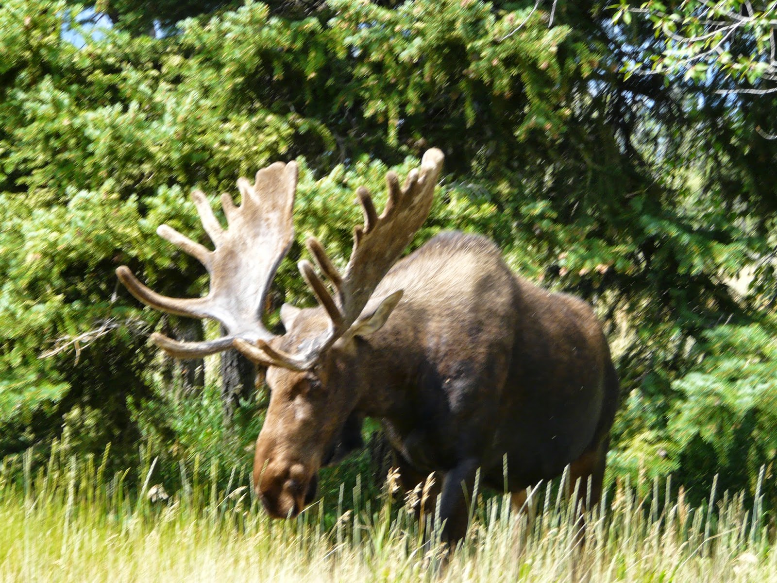
so we headed on back. Mary decided to head north from Norris Junction to see if we could spot some moose along the willows. But we soon ran into construction and were twice stopped to wait for traffic along a one way stretch. We gave up, since it looked like we still had another five miles of construction to go. A better day for the views, even if the traffic didn't cooperate.

Yellowstone Canyon from Lower Falls

Tuesday, August 5, 2014

Yellowstone

We headed south on U.S. 191 toward West Yellowstone. This is beautiful country and that was accentuated by the clouds hanging low over the hills. Since we were unable to make reservations in Yellowstone and the remaining campgrounds had only a few sites that could fit our 26’ trailer, we’re staying outside that park at the West Gate KOA. This is a nice campground with a lot of summer activities, treed sites, and even breakfast and dinner possibilities. But as Mary said, not staying in the park campgrounds is like not staying on Disney properties at Disney World. We’re faced with the huge line of cars everyday trying to enter the park. West Yellowstone entrance is the second busiest National Park entrance, next to the South side of the Grand Canyon. 

We decided to visit the Lower and Middle Geyser Basins as well as Biscuit Basin. It’s cloudy and we had intermittent rain. The crowds are heavier than we've ever seen. One of the rangers said that visitation is up by half a million visitors each summer for the last three summers. We get lucky and manage to find parking at each basin. With the wet weather, the steam coming off the thermal features is heavier than normal. We’ll see if any of the pictures come out. But Yellowstone continues to fascinate us – all the colors, browns, yellows, greens, oranges, and reds. The deep blue or green pools and the fun water action, whether hissing, gurgling, or shooting up in the air. 

Sapphire Pool Midway Geyser Basin

 We arrived at Great Fountain Geyser at 3:45 and the sign said it should erupt between 12:15 and 4:15. There was a crowd so we knew it hadn't erupted yet. We waited, and it began to rain. Mary stayed in the car, I watched from the boardwalks. Several times, the pool started to boil hard, but nothing. It was 4:15, then 4:30, the rain began to pour. I was already wet from the steady rain, and now my socks were starting to get wet. 4:45 – no geyser – time to give up. On the way home, we were delayed twice – once for one lonely elk off the road and then about a 15 minute delay because two bison had settled right off the road, everyone wanted a picture and there was nowhere to park other than the middle of the road. Not our best Yellowstone day!

Great Fountain Geyser

Monday, August 4, 2014

Gates of the Moutains

Today just wasn't our day. We stopped for gas in Browning and it took us over 20 minutes. We headed south and our planned route on U.S. 287 was closed, so we headed east to Great Falls and then back west toward Helena. Our planned stop for the day was at Gates of the Mountains, named by Lewis and Clark as they entered the Bent Mountains. We had planned on taking a boat trip, but because of the delays we weren't going to make the 1:00 boat. So we stopped in a beautiful scenic stop in the mountains for lunch. Expecting something besides the boat trip at this recreation area we went in, and there really wasn't anything other than some historic plaques explaining the ranching history of the area. We headed on to Bozeman and spent the night at the KOA there. 

Bent Mountains Montana

Sunday, August 3, 2014

Going to the Sun Road

Bird Woman Falls

We decided to do a complete loop today by starting to head South then West from our Campground on U.S. 2. If we've ever done this highway, it was long ago. We made our way to the top of Steven’s Pass, named for the railroad surveyor that suggested this as the route for the railway. It’s the lowest pass over the Continental Divide in the state of Montana. Many years, later it also was the route of the Roosevelt Highway connecting Portland, Maine with Portland, Oregon. An interesting factoid: this was the last part of the highway to be completed, for many years, you put your car on a train to get from East Glacier to West Glacier. The ride down the western slope of the pass was much steeper, and we saw that the train track had quite a few places where it was roofed to reduce closures from avalanches.

Bear Grass

From West Glacier, we headed into the park for the Going to the Sun Road. The line of cars trying to get into the park was so long, that eventually they just let everyone through the park entrance without having to stop. This was the start of lots of crowds. I had planned two hiking stops, one at Avalanche Picnic Area and one at Logan Pass. We couldn't find a parking place at either location! But it didn't stop us from having a good time. We stopped along McDonald creek a couple times for pictures and for lunch. Then the road began climbing rapidly. The Going to the Sun Road is a fairly narrow road with dramatic drop-offs, we could often see far below us, where we were only minutes before. Across from us on Mt Oberlin, we could see Bird Woman Falls cascading down 482 feet. We stopped at Lunch Creek on the way down, the bear grass was magnificent. I took a short hike up the stream snapping pictures of the multiple waterfalls and the flowers along the creek bed. We also stopped for the view of Jackson Glacier, the best view from the road of the one of the remaining 25 glaciers in the park. They expect all the glaciers to melt by 2030. On the way home, we took the MT 42, a highway which just barely hangs on to the slope – lots of potholes and rockson the road. But it gave us terrific views of the Two Medicine area, including a view of both upper and lower Two Medicine Lake. Not the day I had planned, but still a fun and interesting day. 


Lunch Creek


Saturday, August 2, 2014

Two Medicine Lake

Two Medicine Lake

I had hoped to camp at Rising Sun campground, but the ranger at the gate told me that our trailer wouldn't fit there, but we might enjoy Two Medicine Campground in the Southeast corner of the park. We've never visited that area of the park and decided to try it. We found a beautiful campsite along the lake where a family was just leaving. I had planned on going up to Many Glacier for the day, but given that we’d never been here, we explored this region instead. We took the short hike to Running Eagle Falls and its nature trail. This was a unique falls. When it’s flowing in the spring it flows straight off the rocks and also underneath a natural bridge that is starting to form there. We just was the falls, look like it’s coming out of the rocks. The flowers along the roadside are in profusion with red, yellow, white, and purple everywhere. And the berries are also starting to form on the bushes. In the afternoon, we took a boat ride along the 2 ½ mile long Two Medicine lake. Cost only $12.25/person, much cheaper than the $64 in Canada for an equivalent ride. The mountains above the lake were somewhat covered from the haze from smoke, but still beautiful.


Running Eagle Falls

In the evening, we listened to Ernie Running Eagle, an elder of the Blackfeet tribe. He gave a talk on the importance of animals to the Native American. He was long-winded, but interesting. He pointed out how animals can detect events before they happen: earthquakes in California, Tsunami’s in Thailand. That they naturally know what plants to eat, to cure their illness. How they are more in-tune with nature than humans. People need to learn from animals, because they have unique powers. We also learned that he was a hero – he was driving a bus of firefighters down the mountain when he lost his brakes. Much as he tried, he couldn't get into a lower gear. He was going faster and faster around the hairpin curves and wasn't expecting to make it. He radioed the bus driver ahead of him that he was in trouble. Then he saw a steep narrow slope up ahead and told the bus driver ahead that he was going to take and try to lay the bus on its side, injuring some, but hopefully no one would die. The other bus driver put his bus underneath that slope and when he laid the bus down, it was on top of the other bus. Almost as interesting as the original story was his story of working with the Hollywood people a couple of years later when they recreated the incident for a show called “911”. He played himself driving the bus (it wasn't moving) trying to get the bus into a lower gear, but, of course, when he was it on TV it looked like he was driving a run-away bus.
After the talk, we could see a bear on the hillside above our campground. He was a long way off, but it still was exciting to see. 


Roadside Flowers


Friday, August 1, 2014

Waterton Lakes National Park

This is the start of a Canadian 3 day weekend, so we were unable to get any reservations near Waterton Lakes National Park. Thus we just passed through the park, visited the town site with the Prince of Wales Hotel standing out above the lake. This hotel was originally built by the American railroads to provide a destination for their passengers where they could drink during the prohibition years. Since we were running late, we didn’t even stop for a short hike, just a few pictures from the road and then on to Glacier National Park. I had reserved a night at Johnston Campground of St. Mary’s, or we probably wouldn’t have found a campsite here either. We had a wonderful dinner at the Lodge in St. Mary’s and a picturesque sunset over the lake. 

Sunset on Lower St. Mary's Lake


Thursday, July 31, 2014

Banff

Lower Falls Johnston Canyon

Today we explored the Bow River Parkway from Lake Louise to Banff. The flowers along the side of the road were spectacular – lots of daisies, with fireweed and Indian Paint Brush intermixed. The skies are hazy with smoke from the near-by fire that has been burning for over a month. Our primary stop for the day was Johnston’s Canyon. We've been here many a time in the rain, but today the sun is shining. We started up, but when the trail became a suspended catwalk over the river, Mary let me proceed on my own. The canyon has seven waterfalls in this 1.5 mile stretch. The lower falls is unique because directly across from it is a cave which had been carved out from the river many centuries ago. It gave a unique perspective on the falls. I continued climbing past a series of smaller falls, until I reached upper falls. Here we had a weeping wall opposite the falls, streaked with yellows and orange rock. The falls itself had both a main falls and a side falls spurting down.

Fireweed along Bow Parkway

We headed for lunch along the parkway, and were hit by a vicious flight of mosquitoes as we ate our sandwiches. We headed on down to Banff and took the Vermillion Lakes road to see the mountains reflected in these shallow lakes. 

Vermillion Lakes


The town of Banff was originally created around a natural hot springs. The dispute for who owned the hot springs here was the original reason they turned this into Canada’s first national park.  While in Banff we stopped at the Park Museum, built in 1903, and now a historical museum. The animal exhibits were created in the early 1900’s, so you could get a feel for a typical museum in that era. Most of the exhibits were stuffed birds and mammals with a few unique artifacts like: a tree limb growing through a rock hole or fossils found in the area. It did allow us to compare the size of a coyote with a grey wolf or distinguish between the many types of hawks that live in this area. The building itself looked modern, they must have done an excellent job in refurbishing it. The town of Banff was filled with people – much worse than Estes Park, feeling more like Aspen. We attempted to go to the original bathhouse, but construction on the road made that difficult. When we couldn't find the bath house, we decided to head back to camp and avoid the crowds here. On the way, we crossed onto the Bow River Parkway and above us on a bridge was a nest of Osprey with at least three youngsters looking like they would be flying soon.

Wednesday, July 30, 2014

Lake Louise

Lake Louise

We beat the crowds to Lake Louise and decided to join Park Ranger Nadine on a 2 hour walk along the lake (at the cost of $15/person). This was the ‘royal tour’ since so much about the lake and mountains has to do with royalty: Mount Victoria (for the Queen) the highest peak behind the lake, Lake Louise (for her 4th daughter, Louise), and Winter, the king of the mountains, holding sway for 8 months of the year. Lake Louise was originally called the Lake of the Little Fishes and then renamed Lake Louise (but for the daughter of the head of the Royal Scientific society, not the Queen's daughter). We also learned that when the railroad first was built, they advertised this as little Switzerland, encouraging mountaineering. And after an initial death on the mountain, they brought in Swiss Mountaineers to guide folks. There was not a single death during the 34 years that they guided the public. This area is one of the best in North America for the tracking of glaciers, since it has been constantly observed since 1895 with photographic evidence. The glacier here has receded since 1840, but has been relatively stable for the last 10 years. We also learned that mountain goats live on the rocks to escape predators, primarily eating the grasses and dried flowers. In the winter, they move to wind-blown slopes to eat, where there isn't a lot of snow. The goat has a cleaved hoof with a soft center that they can use to grip the rocks. Along the shore the flowers were also in abundance, and she identified quite a few different species. The tour ended at the far shore and then we returned to an abundance of people and a parking nightmare. We were happy to leave and find a quiet picnic area down the road for lunch.

Moraine Lake and Valley of the Ten Peaks

In the afternoon, we went to Moraine Lake, just a few kilometers away. Parking was again a problem, but we got lucky. The best view of the Lake was from the rock pile at the outlet side of the lake. From here you can see the expanse of the Valley of the Ten Peaks with Moraine Lake stretching out before us. You can get this same view from the back of the Canadian $20 bill. I walked the shoreline while Mary stayed near the lodge. The population thinned out quickly as I walked. There is a huge ice field that fills a crevice in the mountain opposite the lake, quite a unique sight. The trail ends at the inlet to the lake and the emerald color of the lake stands out from here. By the time I completed this hike it was beer time, so we headed back to camp.


Temple Mountain from our Campground

Tuesday, July 29, 2014

Yoho National Park


We spent the day exploring nearby Yoho National Park. First up, Takakkaw Falls, one of the tallest waterfalls in Canada. To get there you take a road with two hairpin turns, that are so sharp buses actually have to travel backwards between them to get up the road. The falls is only a short walk from the parking lot, but it is so spectacular with its huge drop and about a ¼ of the way down it it’s rock and sprays outward.

Emerald Lake

Our next stop was Emerald Lake where we stopped for lunch. We took the 5.3 km hike around the lake. The easy way is to head clockwise around the lake – which has a flat trail and is easy to turn around when you get tired.  But, because of the angle of the sun, and my desire for nice photos, we went counter-clockwise which required us to go up and then down a hill, before beginning the flat part of the trail. Indeed, it proved picturesque, especially because the reflections were superb in the calm water. But, it made it more difficult to turn around if we got tired, because of the hill. Mary made it completely around the lake, and she was grateful for the flat trail at the end. The path had a lot of contrasts in land and vegetation. The South side of the lake was damp with plants that would normally grow near the Cascade Range on the coast. Then we came to dry-land forest, and finally an area that was wide-open from the avalanches that would regularly pass through. This area sported a lot of Fireweed and Indian Paintbrush.

Yoho Natural Bridge

Our final stop was the Yoho Natural Bridge. The water feature here used to be a waterfall, but the water undercut the rock and left a bridge of stone above with the water shooting through below. 

Monday, July 28, 2014

Ice Field Parkway

Today, we’re heading down from Jasper to Lake Louise on the Ice Field Parkway. The weather is absolutely gorgeous, we’ll have high’s in the low 80’s with the sun shining throughout the day. Our first stop is Athabasca Falls. Here the river is slowing carving away the hard rock, resulting in the falls, many potholes (where the water and silt eat away at the rock in a whirlpool), and the canyon walls. This falls and canyon has a lot more water than we saw yesterday in Maligne canyon. Since the sun was shining we also had a lot of rainbows from the spray of the falls. An interesting factoid about Athabasca Falls, below the falls exist about 7 different species of fish, but above the falls only the Bull Trout can be found.

Goat at Kerkeslin Goat Lick

We proceeded onward to Kerkeslin Goat Lick and sure enough, we had a group of about 6 Rocky Mountain Goats licking up the salt there and creating quite a traffic jam. Further along was Sunwapte Falls, not quite as spectacular as Athabasca. Just as the road began climbing out of the river valley, we came upon Tangle Falls, not in the main river itself, but in one of the tributaries. It was very different, less water, but a large series of falls, quite wide at the top, until unified at the bottom. We pushed to the top of Athabasca pass and then down to the Ice field visitor center. Here is one of the most accessible glaciers in North America just off the highway. Athabasca glacier is about 5 km long one of several glaciers coming down from the Columbia Ice Field on top of the mountains. It has shrunk quite a lot since the last time we were here (per-1996) and they have built a new visitor center. From here we could also see Dome Glacier, it had quite a few more bumps. You can take a ride on the glacier, but the price seemed too steep for the short excursion out onto the glacier. I guess we were spoiled by our helicopter ride to the Glaciers on Mt Cook, New Zealand.


As we continued on into Banff National Park, there were additional scenic stops. The best one was from the Bow Summit, looking North over Peyto Lake and the mountains behind it. Peyto is one of those light blue lakes because of all the sediment from the glacier stirred up in the water. The view was simply spectacular (well worth the 100 feet in elevation gain to get to the platform). We continued into Lake Louise and our campsite for the night. Lucky thing too! The gas warning light came on, just a mile short of our campsite. Which meant that I had my first $100 tank of gas, actually $109. The price was about $5.10/gallon. When we last were here nine years ago, I was outraged at the $2.60/gallon price charged here at that time. We’ll be staying for four nights at Lake Louise Hard Side Campground. It’s a beautiful campground, stretched along the Bow River. Each site is a double site with electricity and a about 20 feet of trees between each of these. The soft side campground is surrounded by an electrified bear fence to reduce bear-people interactions.

View of Peyto Lake from Bow Summit


Sunday, July 27, 2014

Maligne Canyon and Lake

Edith Cavell Mountain

We woke up to a beautiful day in Jasper National Park. We started the day by taking the road to the base of Edith Cavell Mountain. This mountain stands out from the others here because it is covered with snow and has an active glacier on it. The road climbs quickly from the river valley and we are soon rewarded with a view of a U shaped valley reminding us of Yosemite Valley with the granite peaks on either side. At the top was a short path called the Path of the Glacier. We noticed, however, that it looked like part of the parking lot had been swept away by a flood. Sure enough the last third of the trail was considered too dangerous. In August, 2012, a part of the Ghost Glacier calved off and fell in Cavell lake which led to a 3-4 meter swell of water pouring down the canyon. The path remains closed next to the lake in fear that this could happen again.
We headed for Maligne Canyon afterwards, stopping for a picnic lake next to one of the many lakes in the region. The Maligne river got its name from a French trapper who had great difficulty crossing the river, given it the name Maligne like the word, maligned. The canyon is actually a deep gorge with many waterfalls and whirlpools among the rocks. It was quite colorful in spots because of the green and gold mosses hanging next to the white washed rocks. Mary took the first two bridges which were fairly easy, while I went a little further to the third bridge, which was a steeper climb down and back. As we were nearing the parking lot, we caught a rare sight, a mother bear and her cub. The park service had created a fence line to keep people from getting to close to the river, unfortunately the bears were on opposite sides of the fence. We left rather quickly, since we figured this could become a problem when the mother discovered her cub surrounded by humans on the other side of the fence.

We continued down the road to Maligne Lake. The scenery along the way was picturesque, especially the view toward the mountains at Medicine Lake. I had planned to take the 90 minute boat ride to Spirit Island on the lake until we saw that was the price $64/person, about the same as our annual pass to the Canadian Park System. We decided to take a short hike along the lake shore instead. The lake is the deepest in the park, and it has many mountain peaks around it, most still sporting snow in late July.

Maligne Lake

Saturday, July 26, 2014

Jasper National Park

Entering Jasper National Park

We headed southwest from Edmonton along a beautiful 4 lane road. Soon the rain had stopped and within a couple of hours we could see mountains in the distance. Then after coming over the top of a hill, we were in them! We entered Jasper National Park a few miles further along and started following a river. The road never got too steep, we soon found out that Jasper while surrounded by mountains of about 8000 feet is only up about 3500 feet. By 2:30, we arrived at Whistler Campground with over 400 sites, but since it is a Saturday, it’s lucky we had a reservation, the campground will be full tonight.

Pyramid Mountain and Lake

After setting up camp, we went into Jasper to visit the park information office and get some local road and trail maps. On our way out, we were greeted by a gentleman who told us the story of the building (built as the park office and a home) in about 1914. At the time, the only way you could get here was by train. In fact, the road from Edmonton wasn't completed until the mid-1960’s and the road west in the mid-1970’s. After they created the park, people from other towns along the railroad, but in the park were asked to move to Jasper. The train not only transported their goods, but also their house to Jasper. We did a short drive and walk to Pyramid Lake. Behind the lake is the sight of Pyramid mountain, a colorful mountain with streaks of brown and gold (actually pyrite) in the grey stone.

Friday, July 25, 2014

Royal Alberta Museum

We woke up to wind and pouring rain, luckily I had planned a day that would mostly be indoors. (we found out that most flights to/from Edmonton were cancelled today.) After sleeping in, we headed out to the RoyalAlberta Museum in Edmonton. Unfortunately, I misread the directions and we got a tour of downtown quite by accident. We eventually found the turn I had missed and the museum too. This is a natural history museum covering the original people of the area and the minerals, plants, birds, and animals of Alberta. The most extensive exhibit in on the original peoples of the area. Alberta has been inhabited since the end of the Ice Age about 11,000 years ago. We learned about the way of life of these people, their tools, medicines, spiritual practices and how they hunted, fished and eventually farmed this area. At the end of the exhibit, the relations with the European and Canadian government were covered. I don’t know who was treated worse, the American Indian or the First People of Canada. There problems were very similar – treaties not followed, land taken, reservations, discrimination, and the destruction of their way of life. In Canada, they had a period where they were forbidden to even perform their ritual dances. As late as the 1970’s the government was trying to assimilate the people rather than let follow their own culture. That has finally changed since the 1980’s where they now have more control of their health system, education, and society.
As we went through the other sections of the museum, the dinosaur/fossil area was pretty small, they had a lot of dioramas about the wildlife, but the best section was actually on the minerals (both from Alberta and world-wide). They also had a traveling exhibit on leather jackets – how they started as protection for motorcycle and car riders in the 1930’s, but became the signs of rebellion and rock-and-roll in the 1950’s. There were some interesting leather jackets worn by Elvis Presley, the Fonz, and other notable characters.

Indian Fish Trap Diorama

After the museum, we visited the West Edmonton Mall, the original huge mall. Yes, there were lots of stores and an amusement park like in Mall of America, but they also had an ice skating rink, a mini version of Sea World, and a water park within the enclosure. Given all the rain, we enjoyed watching the people – lots of ethnicities, clothes, and interestingly shoes. On the way back to the trailer we stopped at Smitty’s for dinner, they had a great senior meal: main course with vegetables and potatoes, soup, drink, and desert for $10.49. 

Thursday, July 24, 2014

Reynolds - Alberta Museum

Model T Snow Vehicle

We continued on to Edmonton, Alberta today with our one stop at the Reynolds-Alberta Museum, a museum about transportation. Most of the museum is dedicated to the automobile. They had numerous classical cars from the early 1900’s – electric, steam, and gasoline powered. The exhibit continued on with cars from the 20’s through the 50’s. There was also a large exhibit about the transition from horse drawn farm implements to tractors and the significant productivity improvement that resulted, especially when you considered how many farm resources went to feed the horses. A similar point was made about trucks versus horse-drawn vehicles. Within a city environment they could deliver about 4 times as much product in a day. The unique parts of the museum were some of the early motorcycles, and snow vehicles. Particularly interesting was a kit to turn your Model T into a snow vehicle by adding skis in place of the front wheels and a track mechanism to the rear wheels. In another building was a small collection of planes from an early 1908 canvas and wood up through most of the propeller models through the 1940's. For some reason, there was also a recent unmanned propeller driven plane of modern day. The vehicle collection was much more impressive than the plane collection.

Early Steam Tractor

Wednesday, July 23, 2014

Heritage Park

We spent the entire day at Heritage Park in Calgary. Many historic buildings from Alberta have been reassembled here (or in some cases reproduced) to present the history of the province. There are different sections of the park for the various times in history: the time of fur trappers and military outposts, the coming of the railroad, the farming community, and the largest exhibit was the boom times of 1900-1914 displaying many different buildings of the period. The place was swarming with families and children. They kept them happy with a train ride, boat ride, wagon ride, and an amusement park with rides primarily from the 1920-30’s.


Our favorite part of the day was talking with the fur trader, who showed us how to set a muskrat trap and invited us back to set the bear trap that night. We managed to easily spend six hours here: touring the various buildings, taking the train and boat ride, talking to the people explaining many of the exhibits. At the end we briefly visited the Gasoline Alley Museum with many antique vehicles, early gasoline stations, and a large collection of gas pumps. 

Heritage Square


Tuesday, July 22, 2014

Lethbridge to Calgary

Nikka Yuko Japanese Gardens

We started our morning by visiting the Nikka Yuko Japanese Gardens, a tranquil spot in a mostly industrial town. The gardens were small, but beautiful. A lot of effort had been made to build a tranquil setting with ornately pruned trees, carefully placed rocks, and gurgling water features. The pavilion house was set up to be a Japanese Tea room and an exhibit of water painting depicted a pilgrimage to Japan. Our favorite part of the visit though was wandering the pools with their reflections of rocks, waterfalls, and trees. We also just spent time in the gazebo listening to the reverberation of the water against the rocks, a nice respite from the highways.
We continued on to Calgary and tried out the Calaway RV Park. The park is right next to an amusement park of the same name, we didn’t go, but lots of the families did. I can’t recommend this RV Park, because it is poorly designed, most of the utilities are shared between two campsites, and the posts for electricity and water may be too far for your connectors (they do offer extension cords for rent). The sewage connection did not have enough maneuvering room for the connectors.

Old and New Buildings in Calgary

In the evening, we did a rare thing, we visited the center of the city. The famous landmark of the city is the Calgary Tower, but at $18.00/person, it didn’t seem worth going up to see the view. We did, however, walk the pedestrian street, Stevens street nearby. It actually was quite interesting because of the mix of new and old architecture – sandstone classical buildings mixed with the steel and glass of new buildings. The stores stayed open till 5 and then it became a restaurant and bar scene. We had a Guinness and Harp at the Irish Bar along with some Irish Meat Pies, great setting and good food. The prettiest part of Stevens street was near the municipal building, Olympic park. A huge pool of water with fountains and flowers as well as the award platform for the 1988 Olympics. The awards continue, since all the Olympic medal winners are commemorated here on bronze plaques.

Olympic Plaza

Monday, July 21, 2014

Lewis and Clark Interpretive Center

We headed west to Great Falls, Montana to visit the Lewis& Clark Interpretive Center.  We had last visited this museum eight years ago, but I’ll admit I didn’t remember much about it. My intention had been to visit the C. M. Russel museum, but it is closed on Mondays. The museum tells the story of the Lewis an Clark Expedition, beginning with finding equipment and supplies in Philadelphia until they reach the coast of Oregon. It particularly focuses on two areas: the tribes encountered along the way and the 18 mile portage around the five falls in this area. A couple interesting facts about the Indians. First, they spent a winter with the Mandan Indians in South Dakota; here they met a French Fur Trader and his Indian wife, Sacagawea. While she did not guide the party anywhere, she proved instrumental when they needed to trade their canoes for horses in order to cross the Bitterroot Mountains in Idaho. She had been taken by the Mandans from her people as a young girl, and as luck would have it, she recognized her brother as they headed west and he was chief of the tribe. The expedition also had very few problems with any Indian tribes, since she was along, the Indians felt this wasn’t a war party. The other interesting fact about the Indians is that Lewis & Clark, noted the words in each Indian tongue for common objects. Jefferson felt that there would be commonalities among the languages for Indians that had frequent contact. As they crossed the Bitterroot Mountains, the words of the languages changed, indicating a different family of languages and Indians.

Portage around Great Falls

The Great Falls proved to be the toughest obstacle on the entire journey. It took them 2 weeks to portage the 18 miles around these five falls, pulling their dugout canoes on a home-made wooden cart up and down the hills. They lost some of the canoes and had to spend another 2 weeks remaking 2 canoes before they could continue their journey.

Eagle Falls today (one of 5 falls)

After our stop we continued up to Lethbridge, Alberta, Canada to stay at the Bridgeview RV Park, a compact park with lots of trees. The place was filled with RVs from Alberta. As we crossed Alberta, the land changed from ranch land to agricultural land. Everywhere the fields are bright yellow with Canola, but we also see wheat, corn, and flax (in a beautiful blue/purple tint).