Wednesday, October 26, 2011

Back to Nairobi

We flew to Arusha, stopped for some last minute shopping and then drove to Nairobi. Things went well until we got into Nairobi when traffic came to a virtual stop. Our driver finally managed to get onto a side road and circled around to approach our hotel from a different direction. We spent about two hours in this traffic jam.

Today was a sleep-in day. We did a quick walk around downtown to reach the former locations of the U.S. embassy. On August 7th 1998, the embassy was bombed a truck loaded with explosives. The embassy itself was severely damaged, but an office building near-by completely collapsed
during the explosion. 212 people died, mostly Kenyans and 4000 were injured, many blinded from glass shards, others with severe concussions, broken limbs, etc. They had a superb

documentary about the explosion, how they determined who was responsible through forensic evidence and some lucky breaks in the case. This was all planned by Al-Qaede and financed by Bin Laden, a precursor to the World Trade Center 3 years later.
Memorial to those who died at the U.S. Embassy bombing
This afternoon we went to the Nairobi Museum. Its highlights included a large collection of birds of East Africa, a room of mammals (just a subset of what we had seen), the most complete
collection of early human skulls in the world and a display of the stage of life in Kenya as you grow up in the tribal traditions.

We ended our tour with a farewell dinner at a Brazilian restaurant with a selection of local meats including crocodile.
Our farewell dinner
So how do we summarize this trip? We certainly saw more animals than in our last Safari, including all big 5 (Elephant, Cape Buffalo, Lion, Rhino, and Leopard). Going through the herds of migrating animals in the Serengeti was special. We also saw 181 species of birds according to our bird expert, Gail. But the highlight of the trip had to be Cheetahs, the 3 chases we witnessed as well as the hour of watching those six cubs. I'd recommend this trip to anyone who likes nature.

Monday, October 24, 2011

Cheetah cubs

We got up before sunrise and left the lodge as the sun rose. Out highlight of the day came ten minutes later between the lodge and the village. We encountered a mother Cheetah with six cubs about 2-3 months old. The mortality rate for cheetah cubs is high, so to have six is an unusual sighting (it had been five years since our guides had seen this many). While we watching two side-striped jackals approached the group and the mother went into watchful mode (as if hunting) and the cubs immediately quieted. The jackals went off and the cubs went into playful mode, fighting with each other, chasing around, climbing a tree while mom laid down and watched. We spent about an hour enjoying these cheetahs until they finally wandered off into th
e woods., following the white spot at the end of mom's tail.


As we drove to the hippo pool for breakfast, we discovered two Common Eland, the largest antelope in Africa, running parallel with the road. At the hippo pool, besides all the hippos, we saw three crocodiles. It was quiet for our ride home, we spotted a Yellow Billed Stork, a Dark Chanting Goshawk besides the usual Wildebeest, Zebra, Impala, Gazelles, and Warthogs.
Eland running alongside
Our accommodations at the Grumeti Luxury Tented Camp are fairly basic. It's an Ecolodge, most of the power is solar, which leaves the rooms a little dark. But the staff has been terrific, and the food has been a sit-down service, instead of a buffet - very delicious. It's about a half-hour drive outside the park, but as we saw this morning that may not be much of a disadvantage.

Sunday, October 23, 2011

Hippos in the Serengeti

Early in our game drive we came upon a set of vultures and eagles feasting on a carcass. A large white-headed vulture moved some of the kill away from the others.


Our primary stop for the day was a large hippo pool. Two rivers converge here and there were well over 150 hippopotamus in the water. They were primarily resting with the occasional tail twisting to flop water on their back. Since we're at the end of the dry season, there is very little water flow, so the water was pretty foul and smelly. Several times, one hippo would switch positions, another would complain and occasionally it would be taken up by most of the wallow. A few would get out of the to warm-up. But out hunt was for the hippo yawn. It took about 45 minutes of watching but, we finally were rewarded. This is actually a display for other hippos of their large canine teeth.


We stopped for lunch and a nature walk at the visitor center, where the ecosystem of the Serengeti was well explained, including the migration, the vegetation, and the soil conditions.

The afternoon was a bust - no predators, more hippos and Maribou Storks, Vervet Monkeys, and the usual Impalas, Gazelles, Hartebeest, Reedbuck, Zebras, Elephants, Giraffes, and Wildebeest. (Interesting how what was exciting 3 weeks ago has become an everyday occurrence.) We did pass another migrating herd of Wildebeest near our camp. The new bird for the day was the Southern Ground Hornbill.

Saturday, October 22, 2011

Wildebeest migration in the Serengeti


As we went into the park, we soon encountered a large her of Wildebeest on the move. We couldn't see the end of the column of animals 3-5 wide. We traveled about a mile to where they were crossing the road and couldn't see the other end. Our vehicle confused them and the column stopped short of the road, so we pulled up a bit and the migration continued. Hard to guess how many there were, but clearly several thousand animals. We went a little further along and there was a male lion sitting near the road with at least one lioness nearby. Part of our crew had gone ballooning that morning (rising at 3:30 am). They all seemed to enjoy the one hour flight at about 10-50 feet above the ground with a champagne breakfast.


As we continued south into the Seronera valley, we soon found a leopard lazing in a tree. He was hard to see in the shadows of the tree branches. We stopped for lunch on a rise from which we could see all the way across the plains to the Ngorongoro area we had left yesterday. Continuing on we found a second leopard in a tree, this one actually moved from one branch to another, disappearing from view.
Picnicing on the Serengeti
Further along we spotted a large crocodile in a pool with hippos, some Reedbuck antelope then the hit of the day, 9-11 lions lying in the shade of an acacia tree. As the shade moved, one would occasionally get up to move into the shade again.

A group of us retook yesterday's walk, armed with left-over muffins and cookies which the kids appreciated. Along the way, we could hear music from the third day celebration of a funeral. We stopped for a beer in the village and then proceeded to walk toward our camp to see a little more of the village. On the outskirts, they were finishing the slaughter of a pig, something us city boys don't see anymore. All in all, quite a day.

Friday, October 21, 2011

Entering the Serengeti

Today we traversed the Serengeti from Southeast to Northwest. Serengeti means "endless plain" and that's exactly how it felt as came out of a treed area and saw flat grassland as far as the eye could see. The grassland plain is there because the soil is too thin to sustain trees, a layer of volcanic ash on top of volcanic rock.

Of course the Serengeti is well know for the annual migration of Wildebeest. Wildebeest like to drink daily and can only go five days without water. So they move based on where the rains go. Following the Wildebeest are the Zebras who with sharper teeth can eat the grass after the Wildebeest have moved on. Then come the Gazelles who can eat the short grass nubs and can go without water for 3 months. In all, some 2 million animals are involved in the migration.


Shortly after entering the Serengeti, we encountered Gazelles, both Thomson's Gazelles and Grant's Gazelles. once we found them, you could see Gazelles all the way to the horizon. We were traveling about 30 mph and it took forty minutes to reach the end of the herd. We traveled for another thirty minutes with only the occasional animal until we reached Kopjes, a rock island in a sea of grass. Here we found four lion cubs up in one outcropping and 6-8 lionesses (nobody could agree on the exact count because we never saw all of them at the same time. The lionesses were mostly lying around, but the cubs came out and explored.


Just south of the Kopjes, we started driving through Zebras. There was a river nearby with several watering holes, called the Hidden Valley of the Central Plains. The grass here was longer and greener than the plains we had just passed. We traveled for 35 minutes through the herds of Zebras, most in family groups of 4-6 consisting of one male, several females, and their colts. We stopped for lunch at a watering hole with Zebras and Hippos. On the west end of the park, we ran into two herds of Wildebeest heading toward the river. They travel 30-50 kilometers per day and these animals looked pretty thin.


We stopped at the visitor center for break, the Hyrax were eating near the picnic area and we saw a Spotted-backed Weaver and then as we headed west came up close to Hyenas. The group had been asking for some exercise, so once we left the park, we walked about three kilometers to a nearby village. We talked to two Maasai warriors tending a large herd of cattle. They had trucked the cattle across the park because the land was too dry where they lived. Then we came upon a four year old tending 20-30 goats. As we came into the village, lots of kids stopped and waved, yelling "Jambo". Our camp is nice, outside the park, small and isolated. As I'm writing this, we hear Lions, not roaring but making their low hur-hah noise.

Thursday, October 20, 2011

Lake Masek


Lace of Flamingos
Our lodge is just east of the border between Serengeti National Park and Ngorongoro Conservation Area. Today, we explored the land around this lake and Lake Ndutu a little further along. We explored the lace (flock) of flamingos we could see from the veranda - the closest we've been able to approach them. There was also a wallow of twelve Hippopotamus (which we had heard all night long). A little further along we ran into lots of elephants including a male with a massive penis. Soon we happened upon a bat-eared fox lying outside his den. But the highlight of the day was a leopard up in a tree. He was lying on his stomach with all four legs dangling below the branch. We spent about 15 minutes watching has a we moved closer and closer, but he barely moved. Occasionally he would lift his head or open his eyes, but it was clearly time for a cat nap. Behind him we could make out part of an antelope kill. Leopards bring their kill up into the tree to eat undisturbed.
Leopard in a tree
During the morning we also spotted some birds: our best close-up of a Lilac Breasted Roller, Tawny Eagle, Spotted Thick Knee, and a Long Crested Eagle. We also had a variety of antelope: dik-dik near our camp, Steenbok, Marshbuck, and Hartebeest. This afternoon we have some leisure time before our long day going through the Serengeti tomorrow.
Lilac Breasted Roller
That evening Richard had a birthday party with cake and singing for Mary, Flo, and Nancy all who have birthdays in earlier November.

Wednesday, October 19, 2011

Ngorongoro Crater

Ngorongoro Crater
This morning we climbed the crater wall in heavy fog, typical 5 days out of the week. The altitude of the rim is 5000-7000 feet, then we descended into the crater, the third largest in the world. The sky cleared and we went from dense forest to dry plains. After seeing an Auger Buzzard and Kori Bustards, we came upon four female lion lying in the sun near a herd of Cape Buffalo. Looking across the crater we could see the clouds lining the highlands. Then we came upon two male lions with big manes lounging near a swampy area with a huge flock of Blacksmith Plovers. We continued on to the lake in the crater passing hyenas in the distance until we could see a flock of flamingos in the lake. By now it was lunch time and we stopped near a wallow of
hippos with kites swarming above us. Leaving the lake, the terrain got greener and here were the large herds of zebra, wildebeest, and elephants as well as a few cheetah. The crater is its own ecosystem with about 22000 mammals, most of which never leave the crater.

Two lions
Leaving the crater, we exit into dry country. The road is one that continues through the Serengeti to Lake Victoria, yet the road is a rough two lane washboard. We continue on to Olduvai Gorge, the site where the Leakys found footprints from 3.6 million years ago and a skull from 1.6 million years ago. We wander down to the excavation site and find fossilized bones and plant roots from 1.6-1.7 million years ago.

After our visit here we continue on into desolate dry plains, encountering Maasai tending their sheep and goats as well as the occasional village. This is where the government moved many of them when they created Serengeti park. It's allowed to graze cattle, but farming is prohibited in this conservation area. It's approaching dark and we turn at a sign pointing to our lodge 28 km. away. It's not clear that we're on a road, we just continue west along the plains. Eventually we see Acacia tress and about 10 minutes before dark (6:40 PM) we arrive at our very isolated lodge on Lake Masek. It's our group and three other people in the entire lodge. But the food is good and beer and wine come with the meal. It was a long, tiring day, bouncing on that road all day long.

During our drive, Flo and Joe were conversing about where they grew up in New York. After some back and forth about neighborhoods, they discovered that they had graduated in the class of '64 from the same high school! It was a class of 1600, so they hadn't known each other. Mary was so worn out from the dirve that she skipped dinner and went to bed at 7:30.

Tuesday, October 18, 2011

Tloma Mountain Lodge

Today is primarily a break day to relax after going for 2 weeks. This morning we walked through the coffee plantation and on to a Iraqw village. The Iraqw are primarily farmers. We immediately came upon an elder playing a zeze - 2 strings with a calabash gourd sound board with a hide stretched across the open end. Just like yesterday, lots of people, especially the kids would wait for a "Jambo" and then break out into a smile and wave. We passed by the local primary school and then a dispensary and the Lutheran church. In the distance we could see t
he town of Karatu, where we had strolled the marketplace yesterday and on our right hand side was the start of the Ngorongoro Conservation Area. As we walk, we can see where elephants have crashed through the bushes lining the road.

We stop to visit with Martin, who speaks English. He first shows us how they make bricks. Mixing ash with the local clay and water, David, a young man uses his feet to mix the water into the clay. Then with his 2 brick mold, he trows the clay into the mold, flattens it on top and removes the mold. They let the sun dry the bricks for two weeks. After the sun drying, they build a kiln from the bricks, fills it with firewood and bakes the bricks for a day. All this brick building occurs during the dry season from May to October.

Carrying water in calabash gourds
Martin takes us to his home. We take a seat in a circular open hut with a thatch roof, the equivalent of a family room where he entertains guests. Here he explains how they make corn beer and we get to sample this strong home brew. Then mama shows us how the women
traditionally carry water in kalabash gourds - one gourd hung from the back and a second balanced on her head. Flo gets to try it out. The most interesting thing, however, were the goat skin wedding skirts - made from four goat skins and decorated with bead work. It takes about five months to complete one. Mary and the other women get to try them on - Mary thinks she needs a five goat skin version.
Mary and Flo in their goat skin wedding dresses
We also went into a traditional Iraqw house, which is built near a drop-off so the roof can be flat with the land. This was useful, because the opposing warriors could be heard on the roof as an early warning system. They could fight them with bows and arrows when they left the roof. We ended our visit with a small meal of traditional foods: rice, potatoes, carrots, spinach, and lamb. We walked back to our camp and had afternoon free for snoozing, swimming, or reading.

Monday, October 17, 2011

Lake Manyana National Park


We took the back roads into the park, which led us through numerous Toga villages. Everywhere we went people would wave and yell "Jambo" or "Hello". House styles varied from mud sides with straw roofs to brick houses, one even with a satellite dish. Along the way, we stopped at a stream where they were panning for gold. They dug for promising sand then used plastic on the bottom, cloth to catch the heavy particles, and hemp on top. By pouring water on the sand this filtration system trapped the gold for them. The squeezed out the hemp and cloth into a gold pan, and panned the soil for the gold. The three guys we watched had panned about $20 worth of gold in 3 days. The whole family became very friendly as we watched them work.

The park itself was filled with baboons, we encountered 10-12 large troops. There were also lots of elephants. We started out in dense woods at the foot of the ledge for the Great Rift Valley. Then as we went along, the woods disappeared and we were in dried grass when the lake came into view. The lake is at a low point since the short rains (Oct-Dec) were just starting. Across the lake we could see many dust devils, closer in were Elephants, Cape Buffalo, and a few Hippos. The deep forest started again and we came upon a hot spring feeding the lake. Then another dry patch and across the lake you see most of the shore line was pink - thousands of flamingos. Then the forest started again and we spotted Blue Monkeys. Other animals we spotted: Leopard Tortoise, Klipspringer, and a Bushbuck. New bird sightings: Augur Buzzard, Martial Eagle (okay we saw this earlier, but this was a better view), Red Cheeked Cordon Blue, and Little Bee-Eater
Martial Eagle
Later we explored one of the daily markets selling clothes, shoes, pots, and lots of vegetables. We stopped for a beer and drew quite a crowd of kids, teens, and a family including Grandma. Rich bought her a beer, but she complained that she would have preferred the cash.

Tonight our lodge is the Tloma Mountain Lodge which is on a coffee plantation. It's a beautiful place, though the rooms we're in are a little noisy.

Sunday, October 16, 2011

Tarangire Park


We stayed overnight at Lake Burunge Tented Camp across the lake from Tarangire National Park. The lodge is in a village wildlife management area, part of our lodging fees support the village. Raymond gave us some more information about Tanzania. Eighty percent of the people are engaged in agriculture, but as of last year, tourism became the largest industry. There are 15 National Parks and 20 game reserves (for hunting) covering 15% of the country.

Today was elephant day. We saw them tearing down an acacia tree, drinking from holes next to the stream (because the stream was too shallow) and wallowing in the mud. We saw the damage they do to Baobab trees, shredding the tree to get moisture during the dry season. Elephants eat 150-180 kg. per day.


We also saw smaller mammals - a bat-eared fox digging for termites, hyrax feeding in the trees, banded mongoose and a lionness wandering the river banks. For birds the hit of the day was the Martial Eagle, the largest eagle in Africa. This one had killed a Dik-Dik and was eating it under a tree. We also saw Yellow Collared Lovebirds, Yellow Necked Spurfowl, White-Bellied Bustard, a Lilac Breasted Roller, Ruppell's Vulture and an African Orange Bellied Parrot.
Lilac Breasted Roller
Richard had us walk through the Sunday market and we tried some roast lamb. In the evening we took a hike to the lake and encountered fisherman hauling in their nets. We helped them with nets and caught about 30 fish.

Saturday, October 15, 2011

Travel to Tanzania


The Superb Starling
The first hour and a half of our drive was over rough road both in and outside the park. Sometimes we drove the rut next to the road because it was smoother than the road. Along the way, we found a jackal stalking a lone baby goat. Our driver went out and caught the goat and gave it to the Maasai that were driving cows behind us. A few minutes later we passed the goat herder looking for his goat.
Our driver returning the rescued goat
We crossed into Tanzania. Tanganyika gained independence in 1961 without any conflicts, it joined with Zanzibar in 1964 to become Tanzania. It has 40 million people and 126 tribes. The country is 40% Christian and 25% Islamic. They have a lot of arable land for corn, coffee, tea, vegetables, and fruit as well as gold, diamonds, tanzanite, gas, and oil. The big problem is infrastructure: roads, hospitals and electricity. For example, the road we took south of Arusha was brand new last month, most of the roads are still gravel.

We had a superb lunch at Shanga. This place recycles bottles, aluminum and tires into glass beads, spoons, and place mats using deaf, blind and physically disabled folks as their labor force. They really create some unique items.

At dinner we got to know our driver, Raymond. He is Maasai, the youngest in his family. After running away from school four times, the government sent him to a boarding school to complete his elementary education. (The Maasai have resisted education as a large imposition on their culture.) He served his time as a warrior, complete with 2 teeth knocked out on top and bottom of his mouth. Afterwards, he got a bachelor's degree in wildlife management and has now been accepted for a master's degree. Yet he has been a Safari guide for 19 years and after several years as a teacher. Why? He enjoys the chance to share his knowledge of the natural world with tourists. And since he is the youngest son, he is responsible for his parents, and this job provides a healthy income. His brothers are traditional Masai and wonder why he has only one wife. One brother has six wives. When he is home which is about six months of the year, he is traditional Maasai, tending his cows. Raymond toes the line between traditional Maasai and modern life.

Friday, October 14, 2011

Amboseli

We spent the morning learning about the modern life in a Maasai village. Chief Joseph is chief Joseph is chief for a community of 600 people in 13 villages. He is r2 years old, the oldest son of a village of 4 families in one corral, but accepted as chief by other villages in the area. Historically the Maasai are semi-momadic, moving when the grass and water for their cattle fail them. But they have decided to build a permanent village near the elementary school. The warriors move the cattle and may spend a month away from the village. For Maasai wealth is measured by the number of cows they own. But last year, the village's herd declined from 300 to 30 because of the extreme drought.

The men showed how they made fire by friction between an acacia branch and a base of red cedar. They first heat up some goat, cow, zebra, or donkey dung which is crushed into a powder. From there, they light straw and finally wood.

We walked one of the kindergarten boys from the village to the school. Children start school between ages 4-7, when they are old enough to safely walk to schools which might be up to 10 km away. Amboseli elementary has 305 students from kindergarten to eighth grade and includes a dormitory to board students who live 10-14 km away. Students arrive about 7 AM and classes start after the 8 AM assembly. Lessons are in Swahili for the lower grades and English for grades 408. Their native language is Masaai. The standard curriculum is English, Swahili, science, math, social studies, life skills, physical education, and either Christianity or Islam. Depending on you exam scores, you could attend one of 3 styles of high school. But it costs about $300/year which many families can't afford and the nearest high school is 32 km. away, so they must board there. The school was founded in 1992 and new buildings sere built in 2008 by a German donor. OAT just finished a well for the school (the nearest well is 10 km. away) and is finishing one for the nearby village. There next big project is to fence in the school to protect the overnight boarders from animals. School supplies and uniforms are also a problem. We brought a gross of pens which were immediately distributed (they cost $1 each there).

We watched the morning assembly when the Kenyan flag was raised and the anthem sung. The teachers admonished the students to keep the classrooms and toilets clean. They sang us a song and we in turn sang Swing Low Sweet Chariot and Mary had a Little Lamb. The students were taking their mid-term exams that day, we couldn't observe a class, but we did have time to interact with the fifth graders. They asked who our President was, reminding us that Obama's father was Kenyan, how old we were, how many children we had. And we in turn asked about their subjects in school, how big their family was and what they would like to be. They wanted to borrow our watches, asked for pens, and wanted to get their picture taken and take our picture. Technology obviously fascinated them.


We noticed that our guide, Moses, had sandals made from a motorcycle tire and shaped so you couldn't tell which direction he was walking. This turned out to be the common footwear. We visited inside one of their homes. The frame was made of Acacia wood with cow dung walls, cow skins or plastic formed the bottom layer of the roof, with buffalo grass above (to reflect sunlight) and branches on top to hold the grass. The women could build a house in 3 months and it lasts six years. The house has just 2 rooms, one for the parents, the other for the kids and cooking. It was very dark inside since light came only through a fist size hole in the wall, which also served as the chimney. Our house had 2 small beds about the size of a couch with a cow hide mattress, three kids slept in one bed and two in the other.

After lunch, I went to the viewing platform to watch 5 elephants throwing dust for the bugs and drinking from a waterhole. On our afternoon drive we saw the usual antelope and zebra. We also saw guinea hens crossing the road. Then spent most of the time watching two cheetah who were eyeing some Thompson Gazelle. We thought they would give chase, but after a little stalking, they laid back down, but they sure attraced a lot of vehicles! We ended the drive watching the elephants, saw some tussles between young bulls and capped the evening with elephants framed by Mt. Kilomanjaro.

Thursday, October 13, 2011

On the road to Amboseli

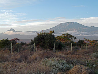
Kilimanjaro from our lodge at Amboseli

We spent most of the day on the road from lake Naivasha to Amboseli. Here are my impressions from the road:
  • People walking everywhere on the side
  • Taking yellow-striped minivans to cover long distances
  • Heavily laden trucks slowing to 5-10 mph on hills
  • Everyone taking risks trying to pass these trucks, especially those yellow-striped vans with 8-12 passengers
  • Many roadside shops selling everything from clothing to auto repair
  • Vegetable stands selling onions, tomatoes, and piles of sweet potatoes
  • Donkey carts carrying barrels of water from the well
  • Motorcycles with gallon milk containers surrounding the driver
  • Wheel barrels loaded with sugar cane for sale
  • All the signs in English, but all the conversations in Swahili or a tribal language
  • Slowing down for speed bumps in the highway in every village.

As we headed south from Nairobi, the land turned drier, much like New Mexico, then we headed up a greener ridge and then back down into the desert. As we turned onto Maasai lands, the soil turned red, giving us red zebras. Kilimanjaro (mountain with the white top) comes into sight, rising from the plains in the South. Finally about 4:30 PM, we reach Amboseli National Park. Amboseli means salt dust because of the dust that rise from the salt flats. The water from Kilimanjaro feeds springs which result in a swamp in the middle of the desert. Here we saw Elephants, Cape Buffalo, and Hippos.
Cape Buffalo, Hippos, and Elephant in the swamp
An exciting find was a Python curled up in a birds nest, then we saw a Saddle Billed Stork and a Kori Bustard. But the hit of the day was a pride of ten lions, lounging around. Apparently, these lions wandered into the park just a few months ago.

Wednesday, October 12, 2011

Lake Nakuru National Park


Today was rhinoceros and bird day as we explored Lake Nakuru National Park. we first met up with a troup of baboons with their babies. Then Cape Buffalo with egrets surrounding them waiting for the buffalo to kick up insects and ox pickers eating the ticks on their hide. As we headed to the water, we encountered a swarm of Great White Pelicans, cormorants, Hadada ibis, and in the water was a waterbuck, above them in the tree was an immature African Fish Eagle. Down the road we went and at a stream we saw an Black Kite, Hammerkop and a Pied Kingfisher. As we approached the open shore of the lake, we found huge flocks of Great White Pelicans, gulls, \ Lesser Flamingos (white) and Greater Flamingos (pink) as well as black-winged stilts, Maribou Storks, and Black Smith Plover.

Near the shore we found 2 white (wide mouthed) rhinoceros. The white rhino is a grazer of grasses, the black rhino is the same color, but browses on leaves, so his mouth is narrow. The two conveniently got up and posed for us before lying down again. Later we found a family of five more rhinos, a male, female, grandma, and 2 young. At lunch, we met David, a Maasai, who was also a bird expert. He took us around the lodge where we ate pointing out the birds: Yellow- billed Barbit, Kenya Rufous Sparrow, Olive Thrush, Hoopoe, the Ruppel's Glossy Starling, and the African Golden Weaver making its nest.

Upon returning to our lodge we walked out to the lake and found an old Hammerkop next, which is huge with an entrance on the bottom. Other birds will use the top of the nest to lay eggs, which being more exposed get eaten by predators first. We saw a Yellow Vented Bulbul, Red Knobbed Coot, and Egyptian Geese. There were hippos in the waters, then while returning, we saw an African Rabbit, Water-Bucks and two Dik-dik. What a day for wild life!
Water-buck at our lodge

Tuesday, October 11, 2011

Nairobi

We flew back to Nairobi last night and today we boarded our minivan to explore Kenya. Our first stop was the Giraffe Center where they are raising Rothschild giraffes and releasing them into the wild. This subspecies of giraffe is the least plentiful, only five hundred exist. We got to feed the giraffes, their 18 inch tongues are quite flexible in order to peal off new Acacia leaves, which are protected by thorns. By holding the feed between our lips, we were both kissed by the giraffes. The young are born after 15-18 months (varied based on weather and food conditions). At birth, they are 6 feet tall and weight 65 kg. Females grow to be 14-16 feet and males to 20 feet. Giraffes nap for 3 to 30 minutes with their eyes open. They protect themselves from predators by kicking. But they are very vulnerable when they drinking water, since they need to spread their legs to drink.

Mary being kissed by a Giraffe

We headed to Karen Blixen's house, the author of "Out of Africa". She moved from Denmark to Africa in 1914 at age 29 and left in 1934, afterwhich she started writing. The home was moderately interesting - less than half of the furnishings were original.

As we continued on, it was obvious when we entered the Great Rift Valley,

which extends over 3700 miles from Turkey to Mozambique. Here 2 tectonic plates are separating. At the bottom of the rift are geothermal features that provide 15% of Kenya's power. The lakes in this area are highly alkaline, since there is no exit to the sea.

Our last stop was Crescent Island where "Out of Africa" was filmed. Most of the animals in the film were brought in and now this is a wildlife refuge. Lots of water-buck, zebras, and giraffe. In fact, we saw a week old youngster with her mother. The island is now a peninsula in Lake Naivasha because of a drought. The area was covered with Yellow Bark Acacia trees.

Mother Giraffe with 1 week old
Our lodge for the night, Lake Naivasha Simba is absolutely stunning on grounds where impala and water-buck are roaming. The room is spacious with both an indoor and outdoor shower and the food is delicious, a mixture of Western, Indian, and African.

Monday, October 10, 2011

Maasai Mara Day 3

George, our Maasai guide

Today's game drive was rather disappointing, we did encounter two jackals, a flock of Superb Starlings, a Mongoose colony, and a lone Southern Reedbuck. Mostly we saw zebra's, wildebeest, and various antelope.

In the afternoon, George told us more about the Maasai people. There are 43 tribes in Kenya from 3 major groups. The Maasai are Nilo-Saharan speakers and came from Northern Africa. They believe in one god, called Enkai, who created the Maasai people and gave them all the cattle in the world as a gift. They live a semi-nomadic existence moving every few years to find grass for grazing their cattle. The tribe historically wore goat skins died red to easily distinguish

their people from a distance (now red cotton has been subsituted). Tradition remains strong among the Maasai. At age nine to twelve, they brand themselves on the arms and legs. The pain prepares them for circumcision at age sixteen to nineteen. The brave ones become warriors to protect the cattle and the tribe. Between ages 27-37, they end their warrior career and become junior elders. At this point, they take a wife, usually through an arranged marriage. In today's age many fall in love with a girl and then have to convince their parents and the elders to arrnge the marriage. You can tell a married man because they carry carry a dark walking stick. Their primary job is to construct a corral and tend the cattle. They often will have multiple wives though given that many have become Christian, this practice is also waning. At age 45 males qualify to become elders. The elders judge the whole community and decide when a person is worthy for their next role.
Maasai moving their cows

Women undergo female circumcision, though the government is trying to discourage this practice. Women usually marry a man 5-7 years older. Women construct their hut, fetch water, cook and tend the children. This is a culture, where they remember how Sampson lost his power when his hair was shaved. So warriors are the ones with long hair, and women shave their heads in this male dominated society. The world of the Maasai is changing. Since 1990, they must get an eighth grade education. In the past they were a barter society, now money exchanges hands. They also have been exclusively cattle grazers, now farming is becoming more important.

Sunday, October 9, 2011

Cheetah chase in Maasai Mara


Last night we had a lecture on the Wildebeest migration. We had chosen the Maasai Mara because I had heard that they should be migrating across the Mara river in October. But apparently, this had occurred in August this year. They travel South to the Serengeti where their calves are born. Today, we're on our way to the Mara river, but on our way we see a cheetah in the distance, while we were watching he gook off in pursuit of an impala. While we thought the impala was a goner, it managed to escape. On our travels, we also encountered Cape Buffalo with Ox Picker birds eating bugs from their backs, followed by Secretary Birds, and vultures. Then we saw 3 cheetahs and watched a second chase, which also failed. Two chases in one day! Right afterwards our vehicle high centered with mud underneath the wheels. We were pulled out by another jeep.


At the river, we saw hippos lazing along the bank and in the water. While we were eating lunch, the vervet monkeys were trying to steal our food. After lunch, we took a walk to see more hippos, and two places where the wildebeest cross the river, one with the remains of a wildebeest skull.
Secretary Bird

It was an uneventful ride home passing Common Eland antelope and Grant's Gazelles as well as the usual zebra, giraffe, impalas, and wildebeest. We were pretty tired after our eight hour drive.

Saturday, October 8, 2011

Maasai Mara, Kenya


It's been interesting getting here. We flew to Chicago and boarded our British Air plane to London. But 10 minutes before departure, the gate personnel asked us to gather our things and leave the plane. Apparently we had a booking to Nairobi, but no ticket. Perhaps it went unnoticed because we did have a ticket to Chicago on United. The British Air personnel, Candy and Jackie, were wonderful They had tried to contact OAT, but couldn't get through. They convinced us to have dinner the business lounge while I contacted the OAT emergency number. In about 45 minutes, we were ticketed on the same flight the next day.

John and Mary in Chicago, rather than Nairobi

BA put us up at the airport Hilton and gave us vouchers for breakfast and lunch. We took the train into downtown and walked around the lake front. BA upgraded us to business class for the flight to London, so we got to stretch out, even if we never fully slept. Our London-Nairobi flight was uneventful and we had transport to the Intercontinental Hotel on arrival. We learned that we were flying to Masai Mara at 10 AM, but we weren't sure about a shuttle to the airport. We woke at 6:15 ready to enjoy a shower, but both the power and water were out. The bell captain called Pulloman, our trip vendor and found out that we were being picked up at 8 AM.
Impalas, Zebras, and Giraffes in the Maasai Mara

We made it to our camp in the Maasai Mora by noon. Only to find that Flo and Bill were missing their luggage, which we had seen last night in Nairobi. (They ended up waiting till our return to Nairobi before they saw their luggage.). The Maasai Mora is one of Kenya's national parks, that is part of the Serengeti ecosystem. It lies just north of the Mara river in South western Kenya.
Enough about the adventure of getting here. We missed seeing a leopard this morning, but we did encounter sleeping lions, a wandering cheetah, and more more zebras, antelope, and wildebeest than you could count. The animals are plentiful - as are the safari vehicles. We would have 7-15 vehicles at each of the lion sightings, a real contrast to the 2-4 vehicles, we encountered in Southern Africa 3 years ago. Just to provide a list, here's what we saw today: topi, impalas, warthogs, Grant's zebra, Masai giraffe, elephant, Thomson's gazelle, Maasai Ostrich, cheetah, lions, and a jackal. Birds included a Rufous-crowned Roller, Grey Crowned Crane, African white back vulture, and a tawny eagle.

Monday, May 23, 2011

Hovenweep

Little Ruin Canyon, Hovenweep


Today, we’re headed to Hovenweep in the 4 corners region. The last time we were here over 15 years ago, we had to travel 20 miles of dirt road, which shook the screws loose on our trailer. Now you can get there on paved road, though the pavement wasn’t always 2 lanes wide. Here there is a collection of towers in about 6 communities from about 1200 AD. Most of the towers are oval or D-shaped and their purpose isn’t exactly clear – were they for worship, storage, or protection? The name Hovenweep means deserted valley named by the first explorers.
We spent the night in Durango and had to revisit the Cypress Cafe, where we had such a fantastic meal last year. Mary was disappointed they didn’t have the Pork Chops with apricots, but we both had delicious meals. The next day we make it back to Fort Collins after 9 hours of driving.

Twin Towers, Hovenweep

Canyon de Chelly


Our guide, David explains the ruins in the Canyon


We’re certainly glad that we took the half day tour with the Navajo, it was a great combination with the rim road. On the tour, we saw quite a few petroglyphs and pictographs from different ages. The earliest were about 2000 years old (symbols, hands, dancing men, snakes), the latest from the 1800’s (running antelope) and in between from the 1600’s, we had figures of men and horses hunting deer and antelope. There were also quite a few cliff house ruins, the most spectacular being white house, with its 2 white towers among all the rust color. We also heard of the Navajo story, particularly the hard times in the 1800s when Kit Carson (as head of the Indian agency) drove all of them out of this area to a Fort in the middle of New Mexico. Many held out on Navajo Fortress, a large rock platform in the canyon, where they could hide from the soldiers. But eventually, they were starved out. On the road to New Mexico and over the next 4 years, half of them died, until they finally were allowed to return to their traditional lands.
In the afternoon, we took the rim road, where you can see more ruins, but at a distance. More interesting was the canyon itself with its steep cliffs, dune shaped rocks, and occasional stone pillars, like Spider rock. The area reminded us of Colorado National Monument, but the valley was much more fertile, a lot of corn and fruit trees dot the bottom of the canyon.

Canyon de Chelly from the rim

Sunday, May 22, 2011

Aztec Ruins National Monument

Original Ceiling (900 years old) at Aztec Ruin


After leaving Chaco, we headed north to visit Aztec Ruins National Monument. Our timing was excellent; we got there just in time for the first ranger talk of the summer. In ancient times, a major road connected Chaco with this complex. The monument was completely misnamed, this is an ancient Puebloan habitation and has nothing to do with the Aztecs, but it got that name, because the original discoverers knew no better. The architecture was very similar to what we had seen at Chaco, though this complex was occupied a little later and longer than Chaco. What made the visit worthwhile was the recreated Great Kiva. Great care was taken to recreate it – the colors match the plaster that was found, the roof was duplicated, as well as the major features. What probably was not done faithfully was the height of the ceiling. Reconstructed Great Kiva
We continued on our way through Farmington to Canyon de Chelly in Arizona. Highway 191 here was very scenic with large red bluffs on either side of the road, cliff like in the east and rounded in the west. By the time we reached the Canyon, it was almost 5 PM, so we’ll do most of our touring tomorrow. We met a couple next to us, with St. Marten license plates, so we had to ask: did you float it across the Caribbean? They’re actually from Florida and on a 6 month tour of the U.S. and Canada. They should be with us during our tour tomorrow.

Saturday, May 21, 2011

Pueblo Bonito

Pueblo Bonito, Chaco Canyon

Today, we took a ranger hike through the largest complex in the park, Pueblo Bonito. This complex had over 600 rooms and 16 kivas, including 3 great kivas. At first, archeologists thought this was a large habitation, but after examining the rubble, there were far too few hearths for cooking. It appears that this complex had only 50-100 permanent residents, but given the large complex, many people most have come here for religious ceremonies or major rendezvous. This area was initially excavated by Weatherill, the same person who discovered Mesa Verde. He is a controversial figure, since he was a self-taught archeologist. He preserved a lot of artifacts giving them to a New York Museum (which has kept most of the items in storage for decades), yet he also did things like burning some of the roofing materials for heat and cooking. The oldest part of the complex has two unique rooms. In one room, Weatherill found over 100 cylindrical jars. This is amazing because only 200 have ever been found in the entire southwest. Two years ago, 3 of these jars were tested to see what they might have contained. It turns out that they held cocoa beans (chocolate). The nearest cocoa trees are over 1000 miles away, but it obviously was considered a sacred substance, just like the Mayans considered it. In another room, they found 6 bodies, buried one on top of each other. These men were over 6 feet tall, in an age where most men were 5’4”. Last year, they carbon dated the man on the bottom; he died about 850, when this complex was first built. These 6 men must have been special because they were buried with all sorts of Turquoise jewelry.
In the afternoon, we visited three other sites in the canyon. Two were great house areas in other parts of the canyon and the last was a residential area. This last pueblo was only one story tall and relatively small. But nearby, was another giant kiva. This kiva has several astronomical setups. First, it is perfectly aligned north and south, as evidenced by a night time picture we saw where it is perfectly aligned with Polaris with the stars rotating around due north (in a time when Polaris wasn’t due North). There also is a window which lights up a nitch in the kiva at summer solstice. Finally the east-west windows are perfectly aligned for the solar equinox. Chaco Canyon is a must-visit on my list.

Friday, May 20, 2011

Chaco Culture National Historical Park

Example of wall construction, Chaco Canyon


We headed up from Albuquerque about 140 miles to Chaco Culture National Historical Park. I was worried about the last 13 miles on a dirt road, but it actually wasn’t too bad – lots of dust and the occasional washboards. We were amazed at how different the construction of building is here than the typical cliff dwellings we were expecting. The best way to explain it is these were the large government or temple buildings built and occupied during a 300 year period which must have been relatively prosperous and peaceful. Roads about 30 feet wide left this area to other pueblo regions of the Southwest. People from at least 4 different language groups would come to this area for ceremonies. These buildings were enormous, 5 stories tall in places.Our first major stop was Chetro Ketl and unfortunately we didn’t find the guide book until the end, so we retraced our steps because the great houses here were like nothing we’ve ever seen. Here we also discovered our first great kiva, about 4-5 times larger than the kivas we’ve seen at other southwestern locations. This complex had about 500 rooms and 16 kivas. There are at least 4 different styles of masonry on the walls. Many of the first floor walls are two feet thick with large rocks with a mud mortar holding them together, but then faced with smaller rocks on the outside in pleasing patterns. Many look as fine as the Inca walls we’ve seen, constructed 700 years later.That night, the campfire talk was about astronomy and the Chacoan people. Almost all their building aligned north-south and many spots in the area are marked for the winter or summer solstice. The sun dagger was a rock formation with a dagger of light appearing at the summer and winter solistace on the spiral petroglyphs. Other spots were marked to watch the sun rise on the winter solstice along notches in the mesas. The talk also pointed out the dirt ramp that angles 45 degrees to the top of Fajada Butte where there is not only the sun dagger, but 40 rooms on each side of the Butte. We finished the night watching the stars. The telescopes were set up to watch Saturn and a couple galaxies.

Great Kiva of Chetro Ketl

Thursday, May 19, 2011

Albuquerque

Petroglyphs


We woke up to temperatures in the low 40s and a stiff wind. Our trip from Sante Fe to Albuquerque was on the Turquoise Byway, New Mexico 14. This was definitely more picturesque than the interstate. It began snowing as we approached the city, so our plan to take the Tram up the mountain definitely didn’t make sense.
We did go to the
Turquoise Museum
, next to Old Town. This proved quite interesting with a large collection of turquoise from all over the U.S. and many parts of the world. We learned that there is white turquoise and that quite often turquoise is processed with oil in order to bring out its colors. Did you know that most of our turquoise today comes from China, and that the original name meant “Turkish”, since in ancient Europe, Turkey was the importer of the stone from Persia.
Instead of going to the Tram, we noticed that Petroglyph National Monument was just outside town. Just outside town, the suburbs were almost up against the fence for the monument. With about an hour’s walk we saw several hundred petroglyphs, most created from 1200 BC to 1700 AD. Being this close to the suburbs, I’m not very hopeful that these will survive. We went to the Range CafĂ© in Bernalillo, just a little ways from the KOA. I highly recommend their North of the Border New Mexican dishes. Both our dinners were great!
Petroglyph with the suburbs in the background

Wednesday, May 18, 2011

Sante Fe

New Mexico History Museum

It was a short drive down to Sante Fe, a town we have visited many a time. The new attraction here is the recently opened, New Mexico History Museum, just behind the Palace of the Governors. The museum did an excellent job of tracing the history of New Mexico from the first Spanish explorers until statehood. They did continue on to the present day, but we didn’t find that as interesting. As you tour the museum, it reminds us that most of what is today’s New Mexico, Arizona, Colorado, Utah, Nevada, and California used to be part of Mexico, which was twice the size of the U.S. at the time. It was President Polk who found excuses to start a war with Mexico, so that the U.S. could realize it’s “Manifest Destiny” to stretch from ocean to ocean. New Mexico history is also filled with other battles with the Indians or between the whites – a lot of violence. The museum was definitely worth the admission.
We then took a drive up into the mountains on the east side of Sante Fe, eventually reaching the ski area. It was a pleasant drive, but I was hoping for more views of the city and West. There are large patches of Aspen as you go up, and we’re visiting at a time, where the lower slopes were just starting to leaf, and the upper slopes were still barren. It made for an interesting contrast. The aspen groves came into being after a forest fire in 1880, so eventually the fir trees will take over.
Our only problem of the day was finding the campground, our AAA book and Mary’s GPS had the directions wrong. Mary had internet connectivity, found their website, and the true directions to the campground.

Tuesday, May 17, 2011

Bandelier National Monument

Bandelier - dwellings in the cliff


We continued on to Los Alamos, New Mexico, stopping at the Bradbury Science Museum, which is the visitor center for the labs here. This is the place where they brought the scientists together to develop the atomic bomb during World War II. The movie, “The Town that Never Was”, is interesting. The town was in an area that Dr. Oppenhiemer had visited as a sickly child. It was isolated, yet close enough to the roads and a railroad. What I found particularly fascinating was the entire town had one PO box number in Sante Fe as their address, many birth certificates also were issued with this address. Of course, the story of developing the bomb is well told in the museum, including the controversy of whether the bomb should have been used at all. They also have copies of some of the original letters around the entire project, such as the letter from Albert Einstein to President Roosevelt that an atomic bomb is possible and Germany may be developing one. The museum also has a display around much of the current work going on there in biology and the human genome project.
Just a few miles down the road is Bandelier National Monument. The highlight of the park is a 1.2 mile trail visiting the various Ancient Pueblo dwellings. The homes here are different than the ones we’re familiar with at Mesa Verde. The cliffs here are made of volcanic tuff, a soft soil that is filled with holes and easily dug. So many of the dwelling were built up against the cliff face using caves into the cliff as the backrooms. Nearer the creek bed are the remainders of a large circular pueblo with three kivas, this was built later. As against many other places we’ve seen cliff dwellings, why people built here is very obvious. The Frijoles creek runs year round, and it has a variety of plants and trees growing there. It’s a beautiful area which sharply contrasts to the desert areas on the canyon rim. If I lived in this area, this is where I would build a home. By the way, the campground here was just rebuilt, all the roads and sites were re-done last year.

Pueblo buildings below the cliffs

Monday, May 16, 2011

Angel Fire, New Mexico

This is our first day out from Fort Collins. We met Beth and Tommy for lunch in Colorado Springs. We brought down the bridesmaid dresses. Holly, one of the bridesmaids, also joined us for lunch. Then we continued down I-25 to New Mexico, turning off on US 64. It didn’t take long for the countryside to completely change from dry plains to mountain valleys. We went through a state park for about 10 miles, encountering quite a few fisherman on the river. Things have been dry here, the entire park is posted with no fires, no charcoal. Then we reached the top of the valley, opening into a wide mountain park. Our primary stop for the day was the Vietnam Memorial State Park. This is a family memorial to a son, which grew over time to a memorial to everyone who served in Vietnam. It’s primary feature is a chapel, but there is also a small museum, which was closed by the time we got there. We stayed at the Monte Verde RV camp, which had just opened for the season. Their office area was still filled with boxes as they moved in.