Saturday, August 9, 2014

Teton to Home

Morning at Oxbow Bend

We left Teton National Park with a grand view from Oxbow Bend. Unfortunately at the top of the pass leaving the park, we hit a deer. I never saw it until it was in my front fender. The car had about $2500 worth of damage, but we were able to drive it home.

So how was the trip? We love Canada's Rocking Mountain Parks and this was the best weather we've experienced there. It was great to explore Jasper Park in more detail, especially Maligne Canyon and Edith Cavell Mountain. The water features in the parks continue to amaze us, all those waterfalls and glacial lakes. It was great to visit the Two Medicine area of Glacier National Park, an area of the park we had never seen before.
Unfortunately, Yellowstone, our favorite park, was just too crowded. We'll have to come either earlier or later in the season next time, rather than during the peak six week period. I wouldn't mind doing all these parks again.

A 14 minute video of this trip with more pictures and video is available on youtube.

Friday, August 8, 2014

Teton National Park

String Lake

On our short drive to Colter Bay Campground, we just missed seeing a Grizzly Bear. People were taking pictures as we approached, but it disappeared into the underbrush. After setting up camp, we headed south to Signal Mountain. For a change, the skies were partly cloudy, rather than overcast. We had contemplated just heading home, since the mountain scenery isn't much with low overcast skies. From Signal Mountain we could see the vast expanse of the flats from here east. But looking west, the Tetons just spring up from the flats and lakes that lie at their edge. We had lunch at String Lake and I took a hike around the lake. I wasn't too worried about bears, since I seldom walked more than two minutes without encountering other hikers, but I learned that they closed the trail later that day for bears. The trees on the far side were bent over, it was obvious that there must have been a significant avalanche or wind blow here since some of the trees were still green. As we drove by Jenny Lake, the temperatures dropped with the wind coming off the lake. 

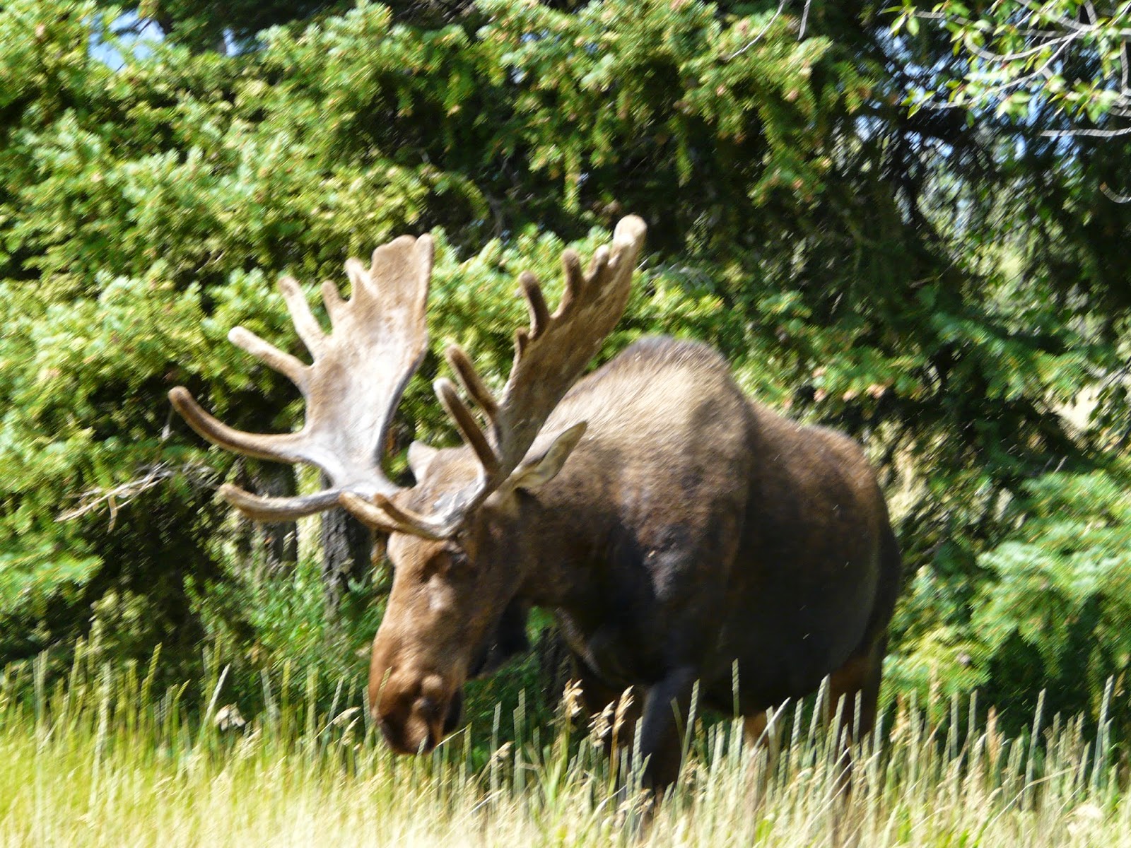
Moose encounter at Menor Ferry

We headed to Menor Ferry and the weather warmed up. We arrived just in time for a ranger talk on the history of the area. Menor established his homestead here in 1894 looking for the best spot for a ferry crossing over the Snake River. It is 20 miles on either side until you can cross the river. He built himself a one room log cabin, expanded it to two rooms the following year, and added a grocery store a few years later. He lived here until 1917. The idea to establish Teton as a national park was started in the cabin of the next owner, a woman named Maude Nobel. She eventually sold her land to John D. Rockefeller who bought over 32000 acres which combined with the Federal land became the beginning of this park. As we were touring, a moose which had been sitting behind the carriage barn, decided to get up and walk to the river. He neatly split our group in two as we tried to avoid him. Almost as exciting as last time we were here and saw a mother bear with two cubs.  It was a nice pleasant day, tomorrow we’ll head for home. 


Wedding at the Teton Chapel

Thursday, August 7, 2014

Upper Geyser Basin

Little Cub Geyser

We packed up the trailer and headed to Upper Geyser Basin. I figured if we got there before 10 AM we would be able to park the trailer and walk the trails around Old Faithful and it worked! This is the largest of the Geyser Basins with Old Faithful at one end and Morning Glory Pool at the other. Our timing was poor to see Old Faithful, so we started the 3.5 mile trail around the Geyser Basin. The sky was cloudy and it sprinkled a couple of times, but nothing serious. So we enjoyed the geysers that go off almost constantly, the blue, black, and red pools bubbling away, and the fumaroles hissing at us as we passed. It’s always such a wonderland. It’s interesting to watch the young families who are viewing this for the first time, and remember when we first saw Yellowstone. As we went along none of the big geysers were going off, but Giant Geyser and Grotto Geyser are still impressive with their large cones and strange shapes. At the end of the trail were the two highlights of our day: Morning Glory Pool with its long clear share of blue water, white rock, and orange rim. It was about 12:30 and Riverside Geyser was expected to go off in the next 1 ½ hours so we decided to wait. Sure enough, at 1:15 we were treated to a huge spray of water up above 100 feet and then falling into Firehole River. We watched for about 15 minutes and then started to head back to the parking lot.  We never did see Old Faithful go off, even though it was in the right time frame on our return, but we were tired and hungry.

Morning Glory Pool

Then we headed off to West Thumb Geyser Basin. We reached there just in time for a ranger hike around the basin area. She did an excellent job of explaining about the Yellowstone Caldera, and the differences between pools, geysers, and paint pots. The paint pots actually weren't very interesting – they had gotten so much snow that the usual pots still had too much water to be bubbling with mud. Our talk was cut short when it began to lightning and thunder, but that was all right, we were ready to head to Flagg Ranch for our camp night. I had to traipse around in the mud to get our camper set-up, we have a small puddle in the back of our campsite. We had dinner at the Lodge – it was okay, but expensive. I can’t say I would recommend this for camping. 

Wednesday, August 6, 2014

Norris and Canyon

We woke up to fog and clouds with the threat of rain. Gibbon Falls was pretty, but we both noticed how much they have changed the road around here. There is more parking now, and what used to be the road is now a walkway to take pictures of the falls. We tried to stop at the Artist Ink Pots on the way to Norris Geyser Basin, but again parking was a problem. In fact, it was hard to even get around the parking lot, because cars were parked haphazardly. Thank goodness I didn't have a trailer on the back, we would have been stuck. Norris was a similar story, after about 15 minutes we did manage to find a parking place. We decided to do the back basin. Steamboat Geyser was spurting about every 2 minutes or so. This geyser has the largest eruption in the park, but the last eruption was on July 31st and given that it has erupted only 2-3 times a year, we weren't going to wait for it. As we got to the furthest point on the 1.6 mile trail, the rain started. The features were interesting and colorful, but we were quickly getting wet again. It reminded me of a Balza clan Yellowstone trip, where we got a picture of all the cousins in their yellow rain coats lined up at the Norris Geyser Basin sign.

We headed off to Canyon and ate lunch in the car on the way there. We stopped on the Virginia Cascades road, this road is in danger of falling into the river. The pullout from which we used to take pictures in no longer there, in fact, it was difficult to get a picture except from the top of the cascade. 

We started our tour of Canyon at Artist Point on the south rim. The rain stopped, and with the clouds the colors really stood out. We found a small hawk in one of the trees here. We also listened to a ranger talk on the animals (primarily birds) that live in the canyon. Then on to Uncle Tom’s trail which leaves you at the base of Lower Falls after climbing down 586 stairs. I’ll admit I had to stop on the way back up for a rest. But it was well worth the effort. 

Lower Falls from Uncle Tom's Trail

Then onto the North Rim where I descended to the top of Lower Falls. You could see the people and the stairs on Uncle Tom’s trail from here. The colors continued to be outstanding, a case where the cloudy day was probably the best weather for the views. We went on to Inspiration point, which was a disappointment. The lower part of the view platform was closed because it was unstable, so you could just barely view Lower Falls. By now it was 4:00 PM, so we headed on back. Mary decided to head north from Norris Junction to see if we could spot some moose along the willows. But we soon ran into construction and were twice stopped to wait for traffic along a one way stretch. We gave up, since it looked like we still had another five miles of construction to go. A better day for the views, even if the traffic didn't cooperate.

Yellowstone Canyon from Lower Falls

Tuesday, August 5, 2014

Yellowstone

We headed south on U.S. 191 toward West Yellowstone. This is beautiful country and that was accentuated by the clouds hanging low over the hills. Since we were unable to make reservations in Yellowstone and the remaining campgrounds had only a few sites that could fit our 26’ trailer, we’re staying outside that park at the West Gate KOA. This is a nice campground with a lot of summer activities, treed sites, and even breakfast and dinner possibilities. But as Mary said, not staying in the park campgrounds is like not staying on Disney properties at Disney World. We’re faced with the huge line of cars everyday trying to enter the park. West Yellowstone entrance is the second busiest National Park entrance, next to the South side of the Grand Canyon. 

We decided to visit the Lower and Middle Geyser Basins as well as Biscuit Basin. It’s cloudy and we had intermittent rain. The crowds are heavier than we've ever seen. One of the rangers said that visitation is up by half a million visitors each summer for the last three summers. We get lucky and manage to find parking at each basin. With the wet weather, the steam coming off the thermal features is heavier than normal. We’ll see if any of the pictures come out. But Yellowstone continues to fascinate us – all the colors, browns, yellows, greens, oranges, and reds. The deep blue or green pools and the fun water action, whether hissing, gurgling, or shooting up in the air. 

Sapphire Pool Midway Geyser Basin

 We arrived at Great Fountain Geyser at 3:45 and the sign said it should erupt between 12:15 and 4:15. There was a crowd so we knew it hadn't erupted yet. We waited, and it began to rain. Mary stayed in the car, I watched from the boardwalks. Several times, the pool started to boil hard, but nothing. It was 4:15, then 4:30, the rain began to pour. I was already wet from the steady rain, and now my socks were starting to get wet. 4:45 – no geyser – time to give up. On the way home, we were delayed twice – once for one lonely elk off the road and then about a 15 minute delay because two bison had settled right off the road, everyone wanted a picture and there was nowhere to park other than the middle of the road. Not our best Yellowstone day!

Great Fountain Geyser

Monday, August 4, 2014

Gates of the Moutains

Today just wasn't our day. We stopped for gas in Browning and it took us over 20 minutes. We headed south and our planned route on U.S. 287 was closed, so we headed east to Great Falls and then back west toward Helena. Our planned stop for the day was at Gates of the Mountains, named by Lewis and Clark as they entered the Bent Mountains. We had planned on taking a boat trip, but because of the delays we weren't going to make the 1:00 boat. So we stopped in a beautiful scenic stop in the mountains for lunch. Expecting something besides the boat trip at this recreation area we went in, and there really wasn't anything other than some historic plaques explaining the ranching history of the area. We headed on to Bozeman and spent the night at the KOA there. 

Bent Mountains Montana

Sunday, August 3, 2014

Going to the Sun Road

Bird Woman Falls

We decided to do a complete loop today by starting to head South then West from our Campground on U.S. 2. If we've ever done this highway, it was long ago. We made our way to the top of Steven’s Pass, named for the railroad surveyor that suggested this as the route for the railway. It’s the lowest pass over the Continental Divide in the state of Montana. Many years, later it also was the route of the Roosevelt Highway connecting Portland, Maine with Portland, Oregon. An interesting factoid: this was the last part of the highway to be completed, for many years, you put your car on a train to get from East Glacier to West Glacier. The ride down the western slope of the pass was much steeper, and we saw that the train track had quite a few places where it was roofed to reduce closures from avalanches.

Bear Grass

From West Glacier, we headed into the park for the Going to the Sun Road. The line of cars trying to get into the park was so long, that eventually they just let everyone through the park entrance without having to stop. This was the start of lots of crowds. I had planned two hiking stops, one at Avalanche Picnic Area and one at Logan Pass. We couldn't find a parking place at either location! But it didn't stop us from having a good time. We stopped along McDonald creek a couple times for pictures and for lunch. Then the road began climbing rapidly. The Going to the Sun Road is a fairly narrow road with dramatic drop-offs, we could often see far below us, where we were only minutes before. Across from us on Mt Oberlin, we could see Bird Woman Falls cascading down 482 feet. We stopped at Lunch Creek on the way down, the bear grass was magnificent. I took a short hike up the stream snapping pictures of the multiple waterfalls and the flowers along the creek bed. We also stopped for the view of Jackson Glacier, the best view from the road of the one of the remaining 25 glaciers in the park. They expect all the glaciers to melt by 2030. On the way home, we took the MT 42, a highway which just barely hangs on to the slope – lots of potholes and rockson the road. But it gave us terrific views of the Two Medicine area, including a view of both upper and lower Two Medicine Lake. Not the day I had planned, but still a fun and interesting day. 


Lunch Creek


Saturday, August 2, 2014

Two Medicine Lake

Two Medicine Lake

I had hoped to camp at Rising Sun campground, but the ranger at the gate told me that our trailer wouldn't fit there, but we might enjoy Two Medicine Campground in the Southeast corner of the park. We've never visited that area of the park and decided to try it. We found a beautiful campsite along the lake where a family was just leaving. I had planned on going up to Many Glacier for the day, but given that we’d never been here, we explored this region instead. We took the short hike to Running Eagle Falls and its nature trail. This was a unique falls. When it’s flowing in the spring it flows straight off the rocks and also underneath a natural bridge that is starting to form there. We just was the falls, look like it’s coming out of the rocks. The flowers along the roadside are in profusion with red, yellow, white, and purple everywhere. And the berries are also starting to form on the bushes. In the afternoon, we took a boat ride along the 2 ½ mile long Two Medicine lake. Cost only $12.25/person, much cheaper than the $64 in Canada for an equivalent ride. The mountains above the lake were somewhat covered from the haze from smoke, but still beautiful.


Running Eagle Falls

In the evening, we listened to Ernie Running Eagle, an elder of the Blackfeet tribe. He gave a talk on the importance of animals to the Native American. He was long-winded, but interesting. He pointed out how animals can detect events before they happen: earthquakes in California, Tsunami’s in Thailand. That they naturally know what plants to eat, to cure their illness. How they are more in-tune with nature than humans. People need to learn from animals, because they have unique powers. We also learned that he was a hero – he was driving a bus of firefighters down the mountain when he lost his brakes. Much as he tried, he couldn't get into a lower gear. He was going faster and faster around the hairpin curves and wasn't expecting to make it. He radioed the bus driver ahead of him that he was in trouble. Then he saw a steep narrow slope up ahead and told the bus driver ahead that he was going to take and try to lay the bus on its side, injuring some, but hopefully no one would die. The other bus driver put his bus underneath that slope and when he laid the bus down, it was on top of the other bus. Almost as interesting as the original story was his story of working with the Hollywood people a couple of years later when they recreated the incident for a show called “911”. He played himself driving the bus (it wasn't moving) trying to get the bus into a lower gear, but, of course, when he was it on TV it looked like he was driving a run-away bus.
After the talk, we could see a bear on the hillside above our campground. He was a long way off, but it still was exciting to see. 


Roadside Flowers


Friday, August 1, 2014

Waterton Lakes National Park

This is the start of a Canadian 3 day weekend, so we were unable to get any reservations near Waterton Lakes National Park. Thus we just passed through the park, visited the town site with the Prince of Wales Hotel standing out above the lake. This hotel was originally built by the American railroads to provide a destination for their passengers where they could drink during the prohibition years. Since we were running late, we didn’t even stop for a short hike, just a few pictures from the road and then on to Glacier National Park. I had reserved a night at Johnston Campground of St. Mary’s, or we probably wouldn’t have found a campsite here either. We had a wonderful dinner at the Lodge in St. Mary’s and a picturesque sunset over the lake. 

Sunset on Lower St. Mary's Lake